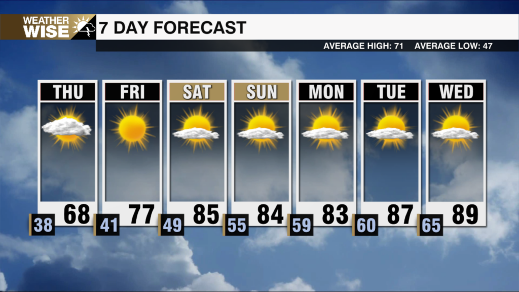
End of The Week Front Will Cool Us Down This Weekend
A mix of sun and clouds with an isolated shower possible on Thursday.
Cold front number 2 of the week will swing through the area on Friday. Expect increasing clouds with an isolated shower possible through the day on Thursday ahead of the front. Rain coverage will turn widely scattered late Thursday through the first half of the day on Friday. The cold front will move in and out quickly, therefore the cold air will be here in time for the weekend! Expect highs this weekend to only top out in the low/mid 60s with lows in the 40s. The mountains will see highs in the 50s and lows in the 30s both Saturday and Sunday. The first freeze of the season across the High Country is possible this weekend.
Tonight: Mostly Clear. Low: 52°. Wind: N 5-10.
Thursday: Mix of Sun and Clouds. Increasing Humidity. High: 77°. Wind: S/SW 5-10.
Thursday Night: Isolated Showers. Low: 60°. Wind: S 3-6.
Friday: Scattered Showers. High: 68°. Wind: N/NW 5-10.
Have a great day!