Another Round of Wintry Mix/Snow & Rain to Kick off your Week
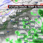
Round 2! Expect the first half of Monday to be cloudy and wet.
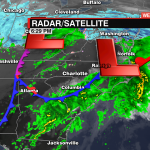
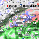
Another round of rain/wintry mix on tap for Monday morning. Though the main source of moisture is now east of us, there is a second-round that will roll through the first half of Monday. Do not be caught off guard if a quick burst of snow/wintry mix occurs across the Piedmont Monday morning. 
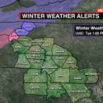
With a northwest flow dominating the Mountains, snowfall totals will increase across the High Country especially above 3,500′ where a Winter Storm Warning is in effect. Above 3,500′ they could see 4-8” of snow with 1-3” possible below 3,500′.
The rain clears out late afternoon/early evening Monday with sunshine and ridge of high-pressure building in through most of the week ahead.
An area of low pressure that has been associated with our rainfall moves from the midwest to the northeast, the northeast braces for big snow through the day on Monday. The National Weather Service out of New York, New York is forecasting 18-24” of snow!