Unsettled Pattern Brings Possible Strong to Severe Storms to South
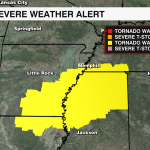
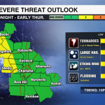
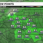
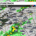
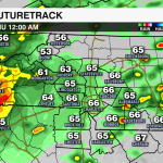
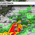
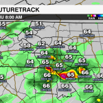
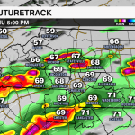
It has been feeling more like spring than the end of December across the southeast with warm, gulf air pumping into the region. A series of disturbances will bring the threat for strong to severe storms each day leading into the New Year. The storm prediction center has put much of the region under a low-end threat for severe weather beginning this evening. A line of storms will move into the region overnight bringing showers and storms – a few of which could produce damaging wind and even a brief tornado. Parts of the south are under a tornado watch until early evening. The timing of this line will limit the severity of these storms as it reaches the Carolinas tonight, but it won’t completely remove the threat. The line of storms will move into the mountains around midnight with rain and storms moving south and east through early Thursday morning. Remember to keep your phone on loud and check that your emergency alerts are on.
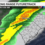
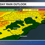
Although this boundary will move out of the region early Thursday, this warm and moist air mass will stay in place keeping the unsettled weather in the forecast through Sunday. On and off rain chances will persist through New Years Day with temps reaching the mid-70s each day this week. A stronger cold front will likely bring severe weather across parts of the south New Years Day. By the time it reaches us (overnight into early Sunday) the severe threat will once again be minimal (timing is important) but, it will still be something that needs to be watched in the coming days. Heavy rain is more likely with this front with 1-2″ of rain possible for the area. Temps will drop drastically behind this line with overnight lows falling below freezing and highs struggling to get out of the 40s Monday.


