Another Weekend, Another Round of Snow
AM Headlines:
- Freezing Temps Thursday Morning
- Dry through Friday Afternoon
- Rain to Snow transition Friday night into Saturday
- Freezing temps will chase the cold front
- Limited Snow Totals
- BUT slick travel still likely Fri PM through Sat AM
- Freezing temps will chase the cold front
- Blustery Saturday
- Sub Freezing Wind Chills
- Warmer next week
Discussion:
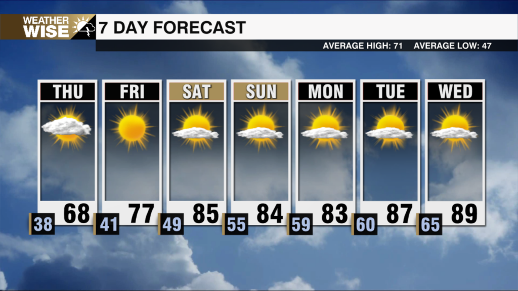
Another weekend outlook with accumulating snow in the forecast. We’ll start today cold and clear with highs closing in on 50 this afternoon. Clouds fill in late with temps falling near freezing tonight. The setup for tomorrow will be different than the last two storms – more of a ‘Classic Carolina Storm’ we’re used to seeing during the colder months. The colder temps will be trailing the front this go-around. Highs Friday will be in the low 50s. Outside the mountains, we will start things off with rain and then transition to snow. This will be the wet, heavy flakes – not the fine powdery snow we saw last week. How fast the colder air arrives, will challenge the forecast totals, but what we usually see with this type of pattern are lower accumulations than what the models suggest. Still, even an inch of snow or slush will make things slick and that, as with the last storm will be the biggest impact Friday night through Saturday morning. Snow will taper off before sunrise Saturday. Winds out of the northwest will make it feel downright arctic with subzero wind chills for the mountains and teens and 20s for the Piedmont and Foothills. Warmer outlook next week with temps back into the 50s Monday.
TIMELINE: (through early morning Saturday):
Mountains – Snow begins early afternoon
Foothills to Piedmont – Rain to snow early evening
TOTALS:
Mountains: 2-4″
Northern Foothills: 1-2″
Piedmont: Up to 1″ (up to 2″ if heavier banding sets up east of I-77)
IMPACTS:
Slick travel Fri PM – Sat AM
Black Ice Sunday AM
Sub-Freezing Wind Chills Saturday