Winter Weather Advisory in Effect Ahead of More Snow Friday
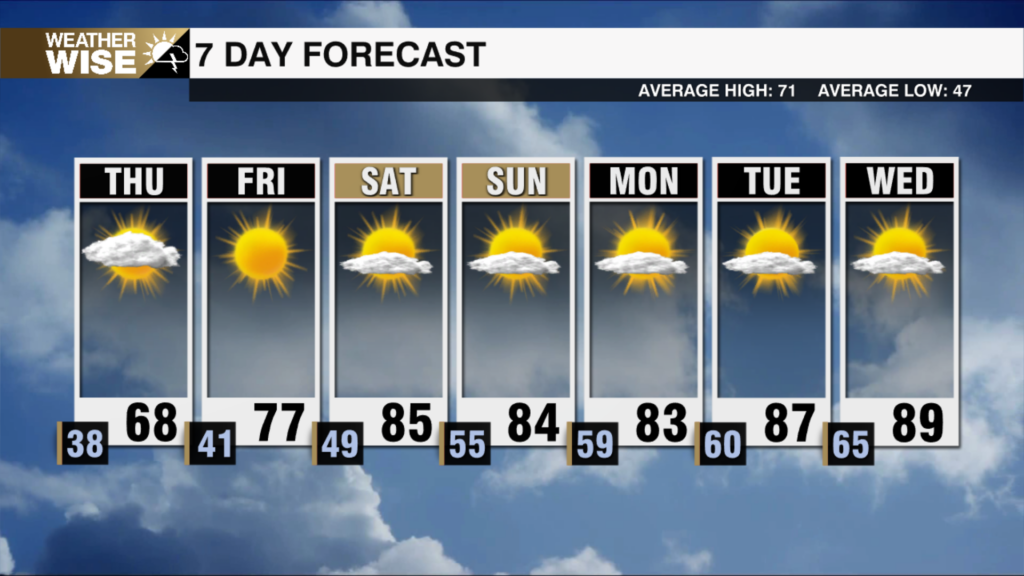
A winter weather advisory goes into effect through Saturday morning for another round of snow across the region. Temps will warm to the upper 40s to low 50s this afternoon. There will be a quick changeover between rain to snow as a boundary moves through the area as colder temps race into the region. Snow will be more wet than powdery, with lower totals all around things look to clear up after midnight. An inch to tops two inches east of I-77 will be possible outside of the mountains with 2-4″+ for the highest elevations. Just a reminder even an inch of snow or slush will make things slick. It will be blustery Saturday with winds out of the northwest 15-20 mph and gusts 30-40 mph making it feel like the teens and 20s for most of the day. Temps will warm into the 50s by Monday with the low 60s by the middle of next week.
TIMELINE:
Mountains: Snow 3pm – 3am
Foothills to Piedmont: Rain to Snow 6pm – 3am
TOTALS:
Mountains: 2-4″ (up to 6″ above 4000′)
Northern Foothills: 1-2″
Piedmont & Foothill: Up to 1″
Piedmont East of I-77: 1-2″
IMPACTS:
Slick travel Fri PM – Sat AM
Black Ice Sunday AM
Sub-Freezing Wind Chills Saturday