Hot Start, Wet & Cooler Finish to Week Ahead
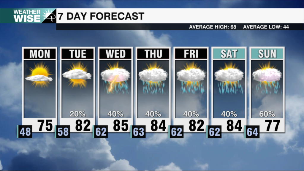
Most communities in the WCCB Charlotte viewing area can expect 1-2" over the next seven days, the majority of which falls over the latter half of the week.
Another day, another record high in the Queen City. As of 4 PM this Sunday, Charlotte has topped out at 80°, re-writing a daily record that has stood since 1956 — 66 years ago. All signs are pointing towards an even warmer Monday. Expect highs in the upper 70s and lower 80s across the board in the Piedmont and Foothills, while the High Country enjoys the mid-60s. However, big changes lurk later in the day.
A strong cold front sweeps in from the west by the mid-afternoon on Monday, bringing gusty storms to our mountain counties. The front weakens as it moves over the Appalachians, but scattered showers and even a few rumbles of thunder arrive in the Piedmont by the evening. Much cooler air sets up shop for the remainder of the week as a more unsettled pattern takes hold of the Carolinas. Rain chances increase through the second half of the week ahead, and most locations can expect a healthy 1-2″ over the next seven days.
Tonight: Mostly clear. Mild. Low: 60°. Wind: S 5-15.
Monday: Very warm with variable clouds. T-showers late. High: 81°. Wind: SW 10-20. Gusts: 25+
Monday Night: Scattered t-showers. Noticeably cooler. Low: 50°. Wind: W to N 5-10.
Tuesday: Partly cloudy. Refreshing. High: 62°. Wind: NE 5-10.


