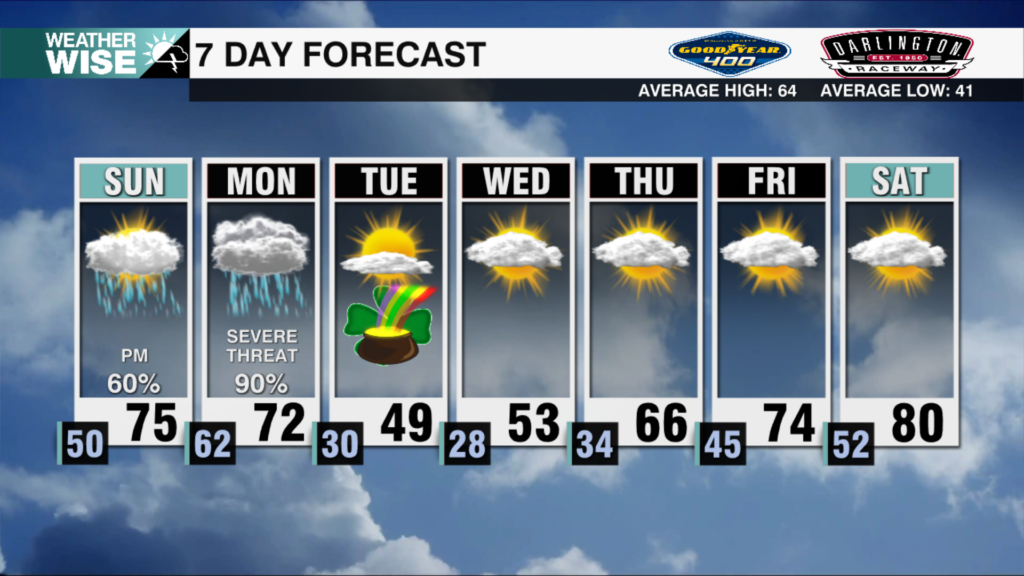
Wednesday Soaker
AM Headlines:
- Steady Rain, A Few Storms
- Severe Threat Limited
- Localized flooding is possible for any storms that sit in place
- Patchy Fog overnight into early Thursday
- Rain Clears Early Tomorrow. Sunny PM
- Rain and storms return Friday night into Saturday
Discussion:
Upper-level low will bring showers and steady rain to the region over the next few hours. Temps will remain cooler with highs struggling to break out of the upper 50s. A few rumbles are possible late this afternoon, but severe threat will remain limited. However, any storms that stall or train over the same area could produce localized flooding. 1-1.5″ of rainfall will be likely with showers tapering off early Thursday. Fog possible for the morning drive, but it will clear by mid-morning. And the Luck of the Irish will be with us with sunshine returning by the afternoon with highs back into the low 70s. However, another cold front will bring more rain and a few storms to the region Friday night into early Saturday morning. Instability looks to be lacking, however, can’t totally rule out a rogue strong storm that is capable of producing damaging wind or even a brief weak tornado. Rain clears early Saturday. Sunny and mild with temps in the mid 60s to end the weekend. Dry through early next week with highs back into the low 70s.