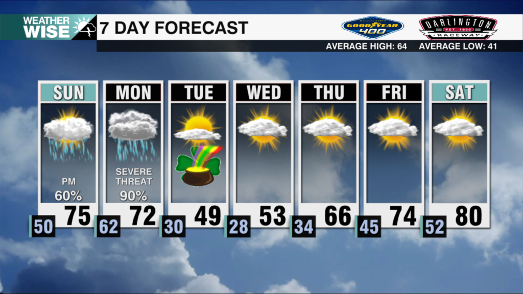
Rain & Storms Return Friday
AM Headlines:
- Scattered Showers & Storms Tonight into Early Saturday
- Severe Threat Limited
- Localized Flooding Possible
- Breezy and Mild Weekend
- Unsettled Mid-Week Setup
- WATCHING:
- Potential Severe Threat & Flooding Issues
- WATCHING:
Discussion:
Clouds fill in today as another disturbance moves closer to the region. Scattered showers and storms begin early evening through early Saturday morning. Severe threat will be limited but, an isolated stronger storm is possible. Flood warning for the Pee Dee River continues through Saturday morning. As of 4am, the river is just under 30′ and expected to crest this morning. Rain and storms taper off early Saturday. Breezy and mild with cooler air moving in overnight. Sunday will be sunny with temps in the mid 60s. Pleasant and warm next week with temps back in the 70s. Take advantage of the dry weather. A potential severe weather setup will occur across the south early next week. As of now, that is looking to be south of the region, however, heavy rain will likely stall across the area Wednesday into Thursday. This could bring more flooding to the area, and will need to be watched in the coming days.