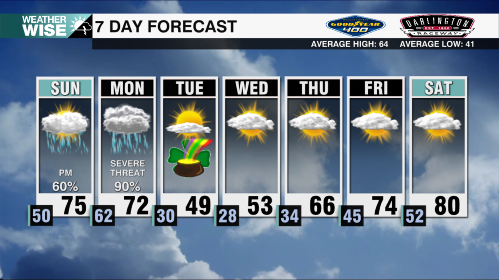
Unsettled Pattern Brings Windy, Stormy Weather Thursday
AM Headlines:
- Windy and Warm Day
- Strong to severe storms are possible
- Increased threat since yesterday
- Level 1 = Low
- Damaging Gusts, Isolated Tornadoes Possible
- Dry, Mild & Breezy Weekend
Discussion:
Yesterday brought another tornado outbreak to the south. Multiple confirmed tornadoes across the south with dozens more likely to be confirmed after NWS surveys today. Windy and warm start for us this morning with temps in the upper 60s and winds out of the south 15-20 mph with even stronger gusts. The line of the storms has fallen apart over the Carolinas this morning with the lack of instability, but similar to last week a few isolated severe storms will be possible during the afternoon with that cold front lagging behind as temps warm into the low 70s. Damaging wind gusts remain the biggest concern, however, an isolated tornado – especially east of I-77 cannot be completely ruled out. Rain and storms and that severe threat will clear by 5-6 pm. Mild, dry, and breezy weekend is back in the forecast.