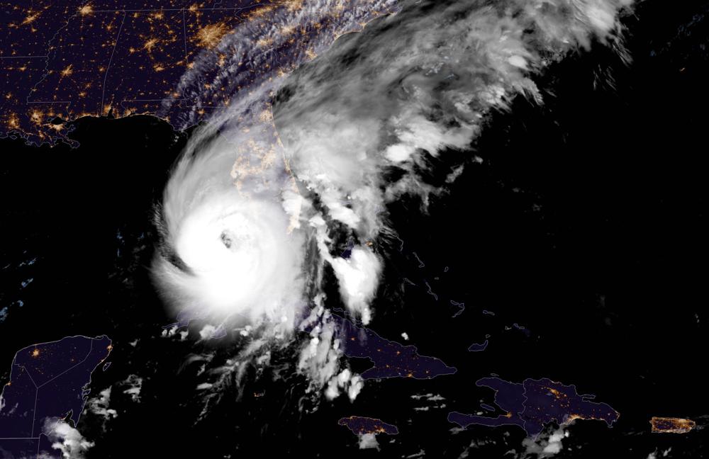
ST. PETERSBURG, Fla., (AP) — Hurricane Ian rapidly intensified off Florida’s southwest coast Wednesday morning, gaining top winds of 155 mph (250 kph), just shy of the most dangerous Category 5 status. Damaging winds and rain lashed the state’s heavily populated Gulf Coast, with the Naples to Sarasota region at “highest risk” of a devastating storm surge.
U.S. Air Force hurricane hunters confirmed Ian gained strength over warm Gulf of Mexico water after battering Cuba, bringing down the country’s electricity grid and leaving the entire island without power.
The hurricane could push as much as 12 feet (3.6 meters) of ocean water ashore in Florida, the U.S. National Hurricane Center in Miami said, urging people to evacuate the danger zone if they still can. More than 2.5 million people were under mandatory evacuation orders, but by law no one could be forced to flee.
Ian was centered about 65 miles (105 kilometers) west-southwest of Naples at 7 a.m., swirling toward the coast at 10 mph (17 kph).
Florida residents rushed ahead of the impact to board up their homes, stash precious belongings on upper floors and flee.
“You can’t do anything about natural disasters,” said Vinod Nair, who drove inland from the Tampa area Tuesday with his wife, son, dog and two kittens seeking a hotel in the tourist district of Orlando. “We live in a high risk zone, so we thought it best to evacuate.”
Winds exceeding tropical-storm strength of 39 mph (63 kph) reached Florida by 3 a.m. and the first hurricane-force winds were recorded by 6 a.m., well in advance of the eyewall moving inland, the Miami-based center said. Rainfall near the area of landfall could top 18 inches (46 centimeters).
“It is a big storm, it is going to kick up a lot of water as it comes in,” Florida Gov. Ron DeSantis said in Sarasota, a coastal city of 57,000 in the storm’s projected path. “This the kind of storm surge that is life threatening.”
Ian’s forward movement slowed over the Gulf, enabling the hurricane to grow wider and stronger, and its predicted path shifted slightly southward, likely sparing the Tampa Bay area its first direct hit by a major hurricane since 1921. But with hurricane-force winds expected over much of the peninsula, many cities could see significant damage.
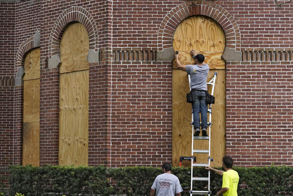
Gil Gonzalez wasn’t taking any chances. He boarded the windows of his Tampa home with plywood and laid down sandbags to guard against any flooding. He and his wife packed their car with bottled water, flashlights, battery packs for their cellphones and a camp stove before evacuating.
“All the prized possessions, we’ve put them upstairs in a friend’s house,” Gonzalez said.
Airports in Tampa, St. Petersburg and Key West closed, as did Disney World theme parks and Sea World in Orlando ahead of the storm.
A couple from England on vacation in Tampa found themselves faced with riding out the storm at a shelter. Glyn and Christine Williams of London were told to leave their hotel near the beach when evacuations were ordered. Because the airport shut down, they could get no flight home.
“Unfortunately, all the hotels are full or closed, so it looks as though we’re going to be in one of the shelters,” Christine Williams said.
Her husband insisted all would be fine. “You know, you got to go with the flow,” Glyn Williams said. “So we’re quite happy doing what we’re doing.”
The precise location of landfall was still uncertain, but with Ian’s tropical storm-force winds extending 175 miles (280 kilometers) from its center, flash floods were possible across the whole state. Parts of Florida’s east coast faced a storm surge threat as well, and isolated tornadoes were spinning off the storm well ahead of landfall.