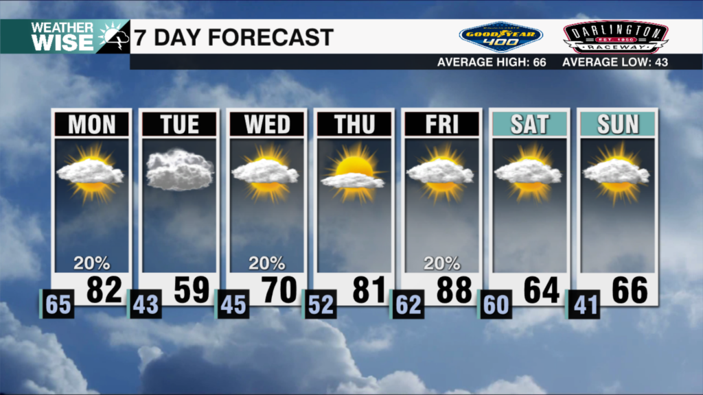
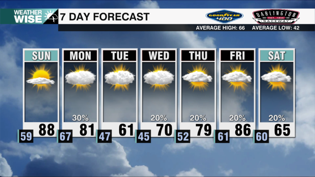
Summer Roars Into Weekend
Stubborn haze will persist through much of the weekend before a cold front cleans us out by Sunday evening.
We’re under two weeks away from summer, but you wouldn’t know it by looking at this morning’s frost in the High Country. Any icy feelings will melt away by Saturday afternoon, as highs soar into the mid-80s across the Piedmont and Foothills. A strong area of high pressure will do its best to keep us clear of rain and haze through the first half of the weekend, pumping in air out of the southwest. Despite the more favorable wind pattern, air quality will still be an issue at times this weekend. Our AQI will vary between 51-101 through Sunday, putting us squarely in the “yellow” (moderate) range, teetering on “orange.”
Our fortunes finally begin to change as we head into our second full week of June. A moisture-laden cold front will sweep into the Carolinas by Sunday evening, bringing widespread showers and storms along with it. Off-and-on rain will last through Monday afternoon before clearing out by Tuesday morning. By and large, rain totals will remain under an inch across the board, but some localized spots will crack this mark. Despite the frontal passage, temperatures should remain in the 80s for most outside of the mountains. Much cleaner air can be expected to settle across the Carolinas through the first half of next week, as well.
Tonight: Mostly clear and cool. Low: 56°. Wind: Light.
Saturday: Sunny and toasty. High: 86°. Wind: SW 5-10.
Saturday Night: Mainly clear early, then variable clouds late. Low: 63°. Wind: S 5-10.
Sunday: AM mostly sunny. PM scattered storms. High: 84°. Wind: NE 5-15. Gusts: 20+