Wonderful Start to Workweek
Despite abundant sunshine, temperatures remain only slightly above average through midweek.
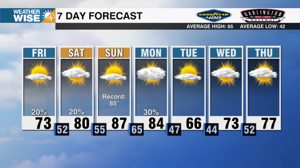
There’s nothing scary in the forecast as we turn the page to October. You can count on sunshine and warm, but comfy, highs in the 70s and 80s over the next few days. A stubborn area of high pressure to our northeast will continue to pump cooler breezes into the Carolinas through midweek. Rain chances will be few and far between as rainmaking systems keep at bay for the next five days.
Our next shot at rain arrives by next weekend as a cold front pushes in from the west. Even then, rain chances don’t look particularly high; models suggest the system begins to dry out by the end of its trek across the country. The highest shower probabilities in our area lie in the High Country. The bigger story with this front will be the cold air packing in behind it. Highs may struggle to get out of the 50s and 60s and lows may approach freezing in the mountains next Sunday.
Tonight: Clear and cool. Low: 58°. Wind: Light.
Monday: Perfection. High: 83°. Wind: NE 5-10.
Monday Night: Another nice night. Low: 60°. Wind: Light.
Tuesday: Sunshine continues. High: 83°. Wind: NE 5-10.