New Month With Warmer Temperatures, For Now
There is a Weatherwise Alert for the weekend
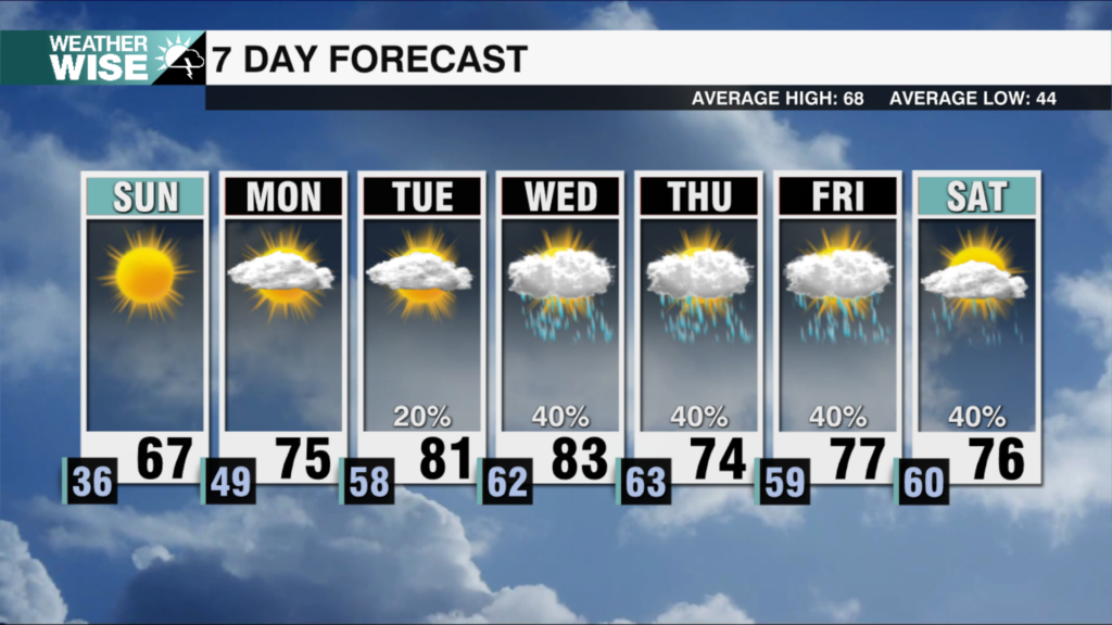
No cold Arctic air at the moment yet…but we will see above-average temperatures return as we kick off the second month of the year.
Plentiful sunshine and highs near 60° carry us through the first three days of February.
This time of the year, when we see much above normal temperatures here, someone up stream is getting much colder than normal weather. That will eventually move our way too! Significant changes arrive as we head into February. Expect highs to top out near 60° through the first three days of the new month as sunshine and southerly winds take hold of the Carolinas. A dry cold front sweeps into our area from the north by the weekend, but temperatures will be slow to react on Saturday. Clouds begin to pool into the WCCB Charlotte viewing area on Sunday, but most will remain dry as temperatures dip closer to average in the 40s and 50s.
A developing wave of Low pressure in the Gulf of Mexico will help to bring us some clouds and showers on Sunday. This system will bring the most rain well to our south, but any movement Northward could bring a deluge of moisture our way in the Sunday through Tuesday timeframe. There is still the potential for wintry weather in the Carolinas, but it doesn’t look particularly likely at this time; a cold light rain in the 40s looks to be the most likely scenario for the Queen City on Monday. Regardless, sunshine will return by midweek next week with near-average temperatures.
Tonight: Mostly clear and cold. Low: 32°. Wind: N 5-10.
Thursday: Sunny and much warmer. High: 60°. Wind: SW 5-10.
Thursday Night: Clear and quiet. Low: 36°. Wind: SW 5-10.
Friday: Sunshine continues. Even warmer. High: 64°. Wind: N 5-10


