WeatherWise Alert: Severe Storms Possible Thursday
AM Headlines:
- Isolated Severe Threat Today
- Afternoon – Early Evening
- Damaging Wind Gusts, Localized Flooding – greatest concerns
- Very Windy Post Front
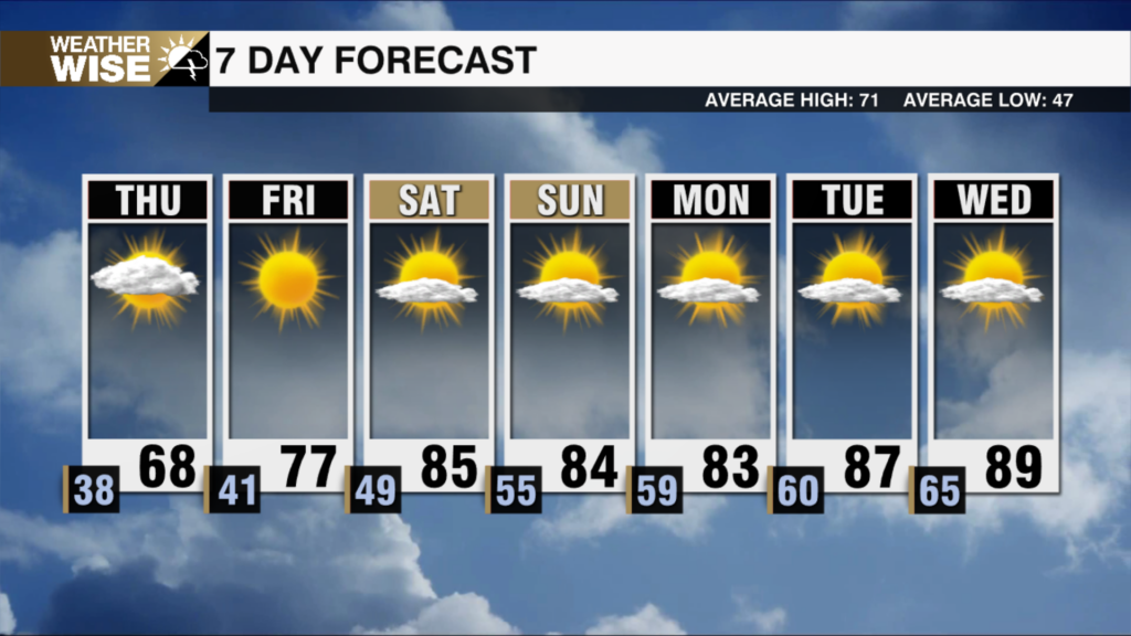
- Dry and warming up this weekend
WeatherWise Alert Thursday:
Afternoon – Early Evening
Damaging Wind Gusts, Localized Flooding
Not as much rain this AM as anticipated, if we see any clearing this afternoon we could have issues with isolated severe storms. Biggest concern remains damaging wind gusts.
Discussion:
Some changes to the forecast. Upper layers of the atmosphere are a bit more dry this morning. This will limit just how much rain we will see for the morning commute. Still expecting some showers and an isolated thunderstorm or two. If we see clearing late morning into the afternoon, that will increase instability, and could lead to a few strong to severe storms this afternoon ahead of the cold front. The biggest concern remains damaging wind gusts, but an isolated tornado can’t be totally ruled out. Localized flooding threat remains with .5-1.5″ possible across the region. Once the front passes this evening, winds will pick up across the area. Expect 30-40 mph gusts through Friday. Warming up with a quiet forecast this weekend. Highs will reach the mid 70s Saturday and low 80s by Sunday. Dry weather stretches through early next week.