Severe Threat Tuesday, Flooding Risk Late Week From Tropics
AM Headlines:
- Isolated Severe Threat Today
- All Eyes on the Tropics
- Flooding Threat
WeatherWise Alerts:
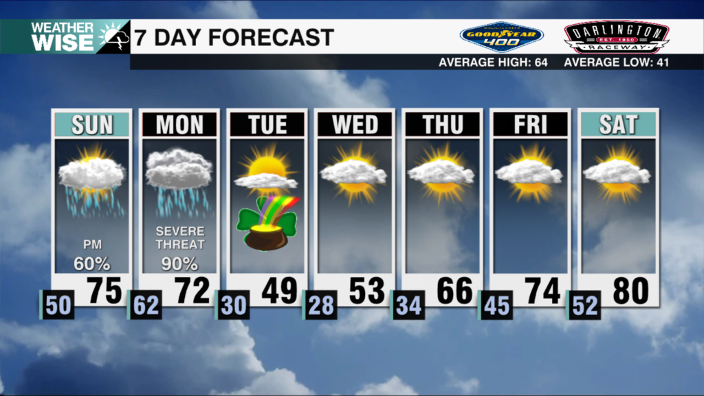
Isolated Severe Threat Today (Level 1 out of 5)
Timing: 2pm – 10pm
Impacts: Damaging Wind & Hail
Impacts from Helene Thursday PM – Friday
Heavy Rain: 4-7 inches expected west of I-77. Localized higher amounts in the mountains
Strong Wind: Gusts 35-50 mph possible for western edge of area
Isolated Tornadoes: A small risk as the center moves into the southeast Thursday PM
Discussion:
A front will stall to our west today leading to scattered showers and storms beginning this afternoon. There is the potential of a few severe storms with damaging wind and hail being the greatest threat through the evening. The severe threat will taper off overnight, but some showers may linger through the morning.
The tropical system south of the Yucatan Peninsula remains potential tropical cyclone 9, but that will likely change today, as what will likely become Helene at some point today pushes into the Gulf, the stalled boundary to our west will help to funnel tropical moisture into the southeast beginning Wednesday. This could set up a high risk of flash flooding for the region. Helene will make landfall along the Florida coast Thursday. As it moves inland, heavy rain, strong gusts and isolated tornadoes will all be possible for the region Thursday night into Friday morning. The center of Helene will track west of the region putting us in the cross hairs of some of the worst inland impacts. Rainfall totals of 4-7 inches possible west of I-77 with up to a foot localized for the moutains. Helene will dissipate west of the region with conditions locally improving by Friday night.