Adding More Much Needed Rain
AM Headlines:
- Soupy Start
- Warm & Humid Midweek
- Steady Rain Tonight
- Weak Cold Front Friday
- Weekend CAD, More Rain
- Hurricane Rafael
Discussion:
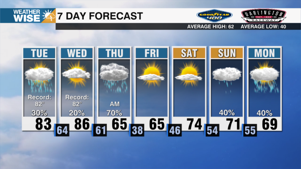
Fog is getting thick across the area with visibility less than 1/4 of a mile in several spots. Patchy fog and drizzle will linger through the morning with cloudy skies and on off rain chances today. Highs will warm into the mid 70s despite the clouds and showers as tropical moisture continues to stream into the area. Steady rain and an isolated rumble of thunder for areas south of I-85 tonight. Temps will stay unseasonably warm with lows in the mid 60s — a good 15-20 degrees above average!
Rain will taper off Thursday morning, but warm temperatures will stick around through Friday. A weak cold front will pass through Friday, leading to a slight cool down for Saturday, but temps remain above average with highs reaching the low 70s.
High pressure off the northeast may lead to another wedge, trapping cooler air against the mountains. This means cool, cloudy and damp weather once again likely Saturday into Sunday. Sunday will be the coolest day of the week with highs in the upper 60s and spotty shower chances returning to the forecast. Temps will warm up ahead of another cold front back into the mid 70s early next week.
Hurricane Rafael
Rafael will continue to strengthen today and could become a major hurricane before it moves over western Cuba later this evening. It will move into the southeastern Gulf of Mexico tonight taking a more westwardly track through the gulf. Impacts will be minimal for the Carolinas as the track keeps the storm well south in the Gulf before moving north toward TX/LA late this weekend as a tropical storm. It will still weaken in the unfavorable environment of the Gulf.