Showers Tuesday, temperatures plummet later this week
AM Headlines:
- Scattered Showers
- Sharp Drop in Temp Thursday
- Windy End to Week
- Mountain Snow
Discussion:
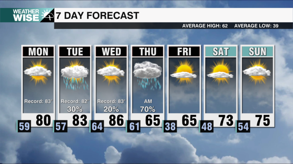
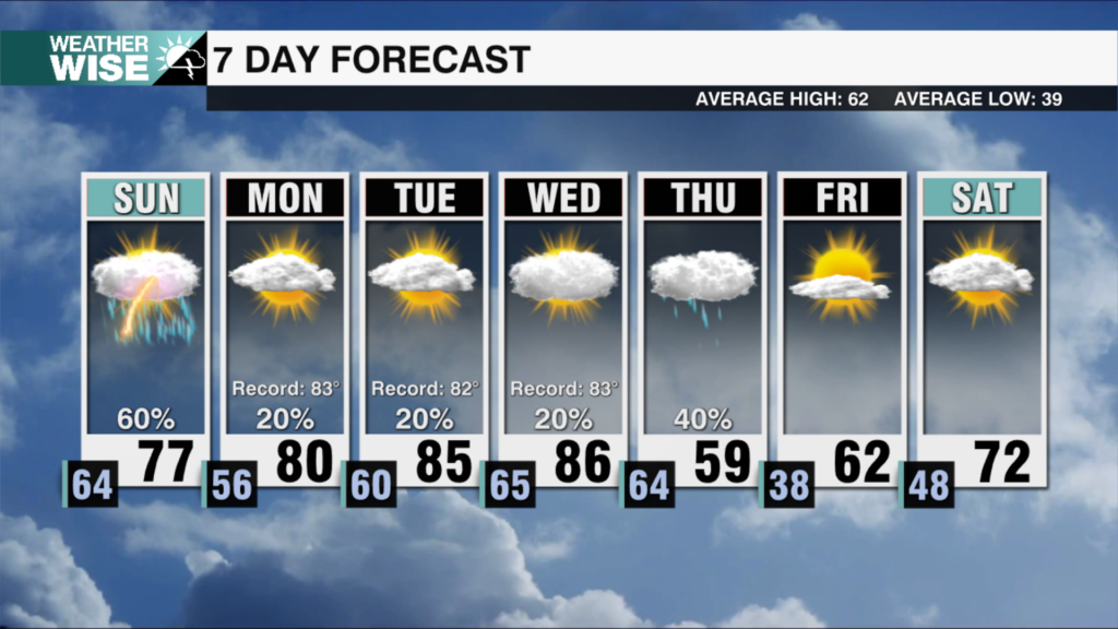
An approaching cold front will bring back rain chances today. Showers move in by late morning and continue through the evening with 0.25-0.50″ across the region. Temps will remain warm with highs topping out in the upper 60s and overnight lows only falling into the upper 50s. Showers will remain possible through Wednesday morning with highs topping out near 70. Once the cold front passes Wednesday, expect temperatures to plummet with lows dropping into the 30s for much of the region. Winds will pick up out of the northwest with highs struggling to break out of the mid 50s Thursday. Snow will be possible for our mountain communities with totals of 1-2″ likely for the NC/TN border through Thursday night. Some mountain valleys may see a few flurries but little to no accumulation is expected. Temps will remain chilly with the northwest breeze Friday as lows fall into the 20s and 30s, but it will feel even colder. Highs will only reach the low 50s Friday. High pressure returns this weekend leading to a clear, but cool forecast with lows in the 30s and highs in the upper 50s Saturday and Sunday. Temps will begin to warm up by early next week.