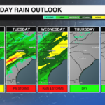
Heavy rain and isolated severe threat Tuesday night
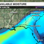
A deep dip in the jet stream is is driving an impressive surge of moisture into the southeast and Carolinas. The atmospere will be able to hold 2-3 times the amount of moisture that it normally does for this time of year. A strong cold front enhanced by an upper level disturbance will tap into this moisture setting up the threat of heavy rain and potential flooding Tuesday night through the first half of the day Wednesday.

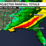
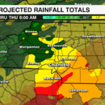
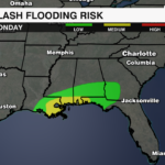
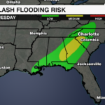
The Weather Prediction Center has highlighted the Carolinas for potential localized flooding as rainfall rates could exceed more than 1 inch per hour, as storms could train ahead of the cold front bringing several rounds of heavy rain over the same areas. Rainfall totals of 1-3 inches will be possible with the highest rainfall totals likely near and south of I-85.

Spotty showers will begin Tuesday afternoon with the rain becoming more widespread Tuesday evening. Heavy downpours and thunderstorms will develop south of I-85 after 8pm Tuesday. The heaviest rain will arrive after midnight. This is when thunderstorms producing heavy rain may train leading to localized flooding. Rain will taper off by the early afternoon once the cold front pushes east of the area.

While heavy rain is the biggest concern, there is a non-zero severe threat as well. Damaging wind will be the biggest concern with the strongest gusts after midnight and through Wednesday morning.
Now is a good time to clear storm drains to prevent water from pooling and secure loose items and holiday decorations. Allow extra time for the Wednesday morning commute. Make sure all devices are charged in case of power outages.
Download the WCCB Weather App to keep up to date on the latest forecast.


