Soggy start to the work week
AM Headlines:
- Wet Morning Commute
- Warmer Start to the Week
- Tuesday PM Storms
- Isolated Severe Threat, Localized Flooding
- Much Colder Late Week
Discussion:
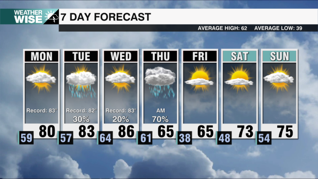
It will be a wet start for commuters with ongoing showers across the region. This will taper off by late morning after about .25″ of rainfall. Highs will reach the mid to upper 50s this afternoon under mostly cloudy skies. Some patchy overnight fog possible with lows only falling into the low 50s. Tuesday will bring some light on and off showers with highs reaching the mid 60s. Heavier rain builds in later in the evening with the potential for a few storms as a cold front nears the area. An isolated severe storm is possible with damaging wind the greatest threat. Rainfall totals of 1-3″ will be possible which could lead to a localized flooding threat. Rain moves out west to east Wednesday but colder and gusty winds quickly follow with temperatures falling through the afternoon. We could see some mountain snow for west facing slopes near the TN border. Drier and colder air settles in Thursday with lows in the 20s and highs only reaching the 40s. Temperatures gradually warm back into the low to mid 50s by the end of the weekend.