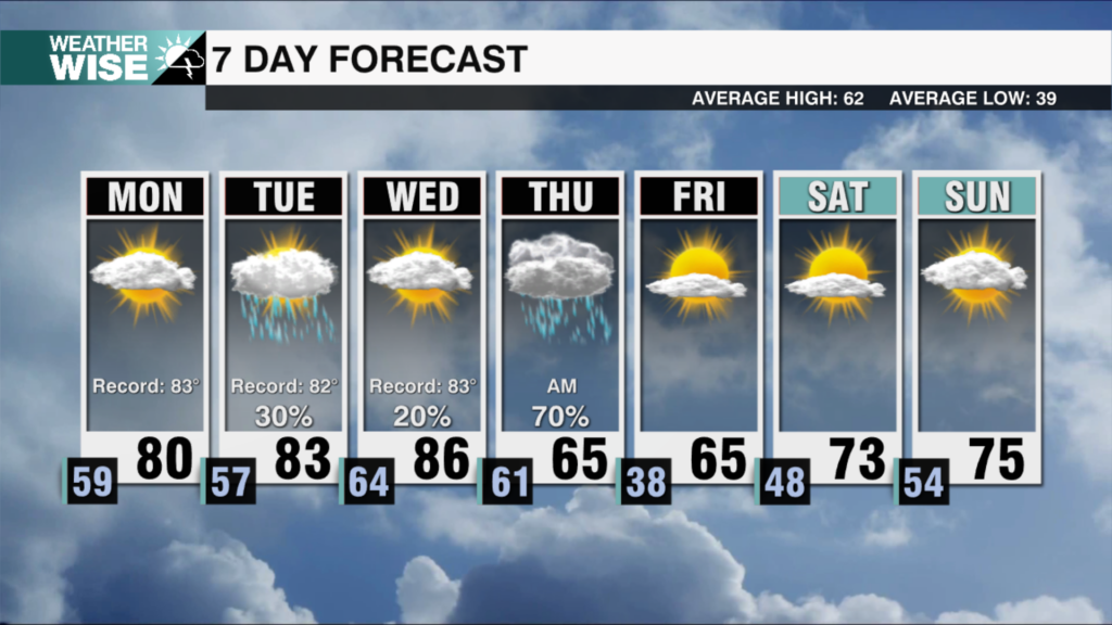
Heavy rain, localized flooding threat
AM Headlines:
- Dense Fog Advisory
- Heavy Rain Tonight
- Localized Flooding Concerns
- Gusty Winds Wednesday
- Much Colder Late Week
Discussion:
Widespread dense fog will linger through mid-morning. Dense Fog Advisory in effect until 10am for all counties along and north of I-40. Highs will top out in the low to mid 60s today with showers beginning this afternoon. Heavy rain triggered by an upper level disturbance and approaching cold front will begin tonight with 1-3″ likely to fall through Wednesday morning. Some areas within the Piedmont may receive up to 4″ of rain depending on where storms tend to train. This could lead to localized flooding for low lying and urban areas by the Wednesday morning commute. A strong cold front will cross the region from west to east tomorrow bringing gusty winds and an end to the rain. Temperatures will tumble post front with 1-3″ of mountain snow possible for west facing slopes near the TN border through Wednesday night. For the rest of the region it will be dry and cold with temperatures falling below freezing by Thursday morning. Temps will struggle to break out of the 40s through the start of the weekend. Temperatures will regulate by Sunday with highs back into the mid to upper 50s through early next week.