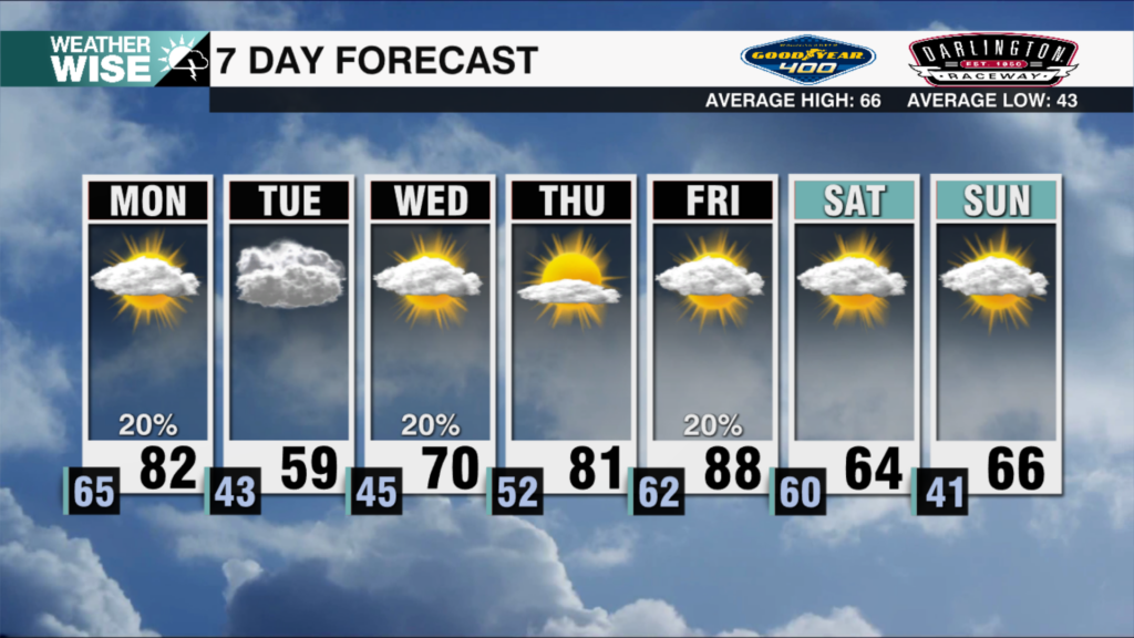
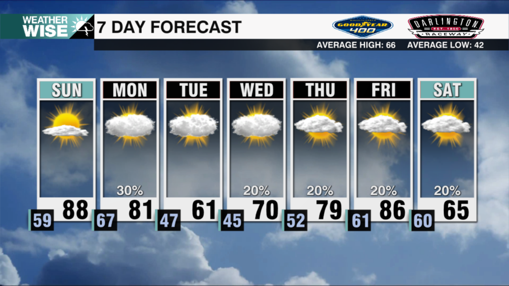
CHARLOTTE, N.C. — We’re down, but we’re not out – at least not yet. That said, if you’re dreaming of a snowpocalypse in the Queen City, you’ll likely be sorely disappointed. Here’s the breakdown:
KEY POINTS
- Dangerous wind chills arrive Mon AM
- Moisure arrives Tue PM, exits Wed AM
- Appears SE trend is winning out
- Best chance for wintry wx lies SE
- *IF* you get moisture, will be all snow
- Measurable snow unlikely for Metro & NW
- Up to 1″ possible in Sandhills
- Esp. Richmond & Chesterfield counties
FORECAST CHALLENGES & CAVEATS
- How dry will this Arctic blast be?
- Will eat away at snow from N
- Happened with last week’s storm
- May leave Metro snowless
- Could undermine any NW trend
- Will eat away at snow from N
- Storms tend to trend NW closer to event
- Happened with last week’s storm
- Could lead to slightly higher totals
- Will also put more locations in play
- Any additional trend SE could completely whiff us
- STORM HAS NOT FORMED YET
- Forecast becomes clearer once formed

BOTTOMLINE
We want to be clear here: snow chances aren’t looking great for the Queen City. The farther south and east you go, the better shot you have to see flakes. Having said that, the system heading our way hasn’t even formed yet. There’s still time for some significant changes, but our window is closing fast. Any small shift – whether it’s NW or SE – will have major implications for the forecast. Stay weather-wise. Keep your expectations tempered.