Warm relief steadily builds
Highs may surge well into the 60s by midweek next week.
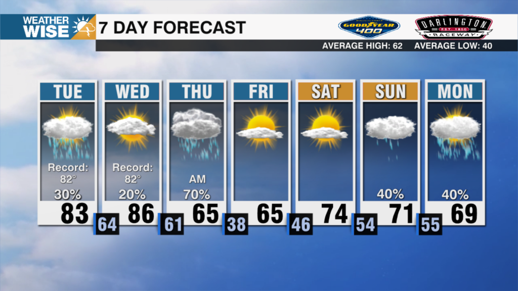
Happy Friday! It’s been a bitterly cold – and wintry – week for many of us in the Carolinas, but spring-like temperatures aren’t far away. Lows take another deep dive tonight into the teens and 20s as we kick off the weekend. While the warmth won’t rush in all at once, highs around the Metro and southeastward will top out near 50° – easily the warmest air we’ve seen since Sunday. Temperatures take another step in the warmer direction on Sunday as the mid-50s should settle into the Queen City in the afternoon.
Clouds build in to close out the weekend as a cold front approaches from the northwest. While most of the moisture associated with the incoming system will stay to our south, a few showers may roll into the WCCB Charlotte viewing area Sunday night into Monday morning. Despite the passage of said cold front, temperatures shouldn’t drop much – if at all – on Monday. For now, highs will hover around the mid-to-lower 50s across the Piedmont and Foothills for the first day of the workweek. The warmest air of 2025 arrives by midweek next week; highs may swell into the 60s in the Metro on Tuesday and Wednesday.
Tonight: Mostly clear. Cold. Low: 24°. Wind: Light.
Saturday: Mostly sunny. Still chilly. High: 49°. Wind: SW 5-10.
Saturday Night: Clouds build. Remaining cold. Low: 28°. Wind: SW 5-10.
Sunday: Mostly cloudy. A bit milder. High: 55°. Wind: SW 5-10.