Severe storms possible Thursday in the Mountains and Foothills
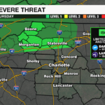
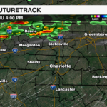
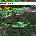
The Storm Prediction Center has highlighted a level 1 (out of 5) severe risk for Western North Carolina, including the Mountains and Foothills Thursday afternoon and evening. A boundary west of the region has sparked several rounds of rain and storms across Kentucky, West Virginia and Virginia this morning. An upper level disturbance will trigger more storms this afternoon that will likely track into the region this afternoon and evening.

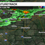
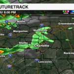
Strong upper level winds will help storms stay organized, while temperatures warm into the 60s and 70s providing fuel for storms to intensify. The strongest storms will be possible after 3 p.m. through midnight.

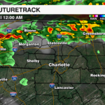
The biggest concern will be damaging wind and up to quarter-sized hail, while the tornado threat remains low – however, not zero. Storms will weaken quickly outside of the mountains before reaching the Charlotte Metro area, but a few stronger cells could have enough momentum to hold together into the Western Piedmont.
Rain and storms will dissipate after midnight with showers ending before daybreak Friday.
Download the WCCB Weather App for the latest information on today’s storms from the WCCB WeatherWise team.


