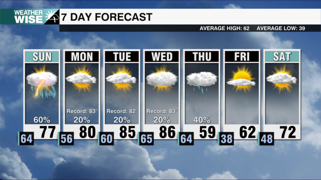
Monday showers, pleasant and warmer midweek
AM Headlines:
- Monday Rain
- Warm and Dry Midweek
- Weak Cold Front Thursday
- Weekend Storms
Discussion:
Rain moves in today as a low pressure system over the Florida Panhandle pulls moisture north along a stalled front. The heaviest rain will stay south of I-85, with up to .5″ possible. Showers taper off this evening setting up a big warm up mid-week as high pressure sits over the region. Highs will reach the mid to upper 70s under sunny skies. A weak front may bring a few sprinkles west of I-77 Thursday, but the bigger focus will be a strong weekend cold front Saturday night into Sunday. This front will bring heavy rain and gusty wind with the a low end severe threat, but storm strength depends on timing — if the front mvoes through overnight, instability will be limited. Something we will be watching over the next couple of days.