Pleasant and warmer, weekend storm threat
AM Headlines:
- Warm & Dry
- Elevated Fire Danger
- Limited Rain Chances
- Weekend Severe Threat
Discussion:
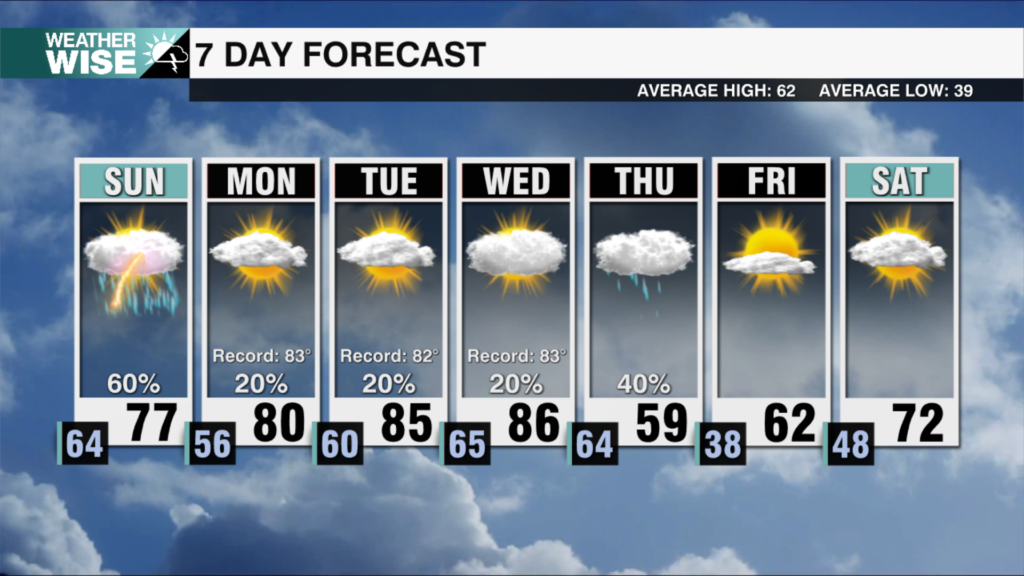
We’re in for a warm and dry stretch through midweek with plenty of sunshine and highs pushing into the mid to upper 70s, beginning this afternoon. There will be an elevated fire danger, especially for the High Country and Foothills, where dry air is mixing down and humidity is dropping into the 15-25% range. Outdoor burning should be done with extreme caution.
By Thursday, clouds increase and a weak system brings isolated showers to our west, but with dry air in place and the disturbance weakening, rain chances locally will be limited. Temperatures stay well above normal with highs reaching the mid 70s — even with added cloud cover. It will remain dry through the end of the week.
The focus shifts ot this weekend. A strong system will develop over the the central U.S. and track east, bringing the potential for heavy rain, strong wind and possibly severe storms late Saturday into Sunday. Right now, the biggest concern is a line of storms moving through overnight, which could bring damaging wind and even isolated tornadoes. Heavy rainfall could also lead to localized flooding. Confidence is increasing that there will be a storm threat, but the exact timing and threats could change over the next few days.