Quiet and warm end to the week, increasing severe threat late weekend
AM Headlines:
- Staying Warm & Quiet Friday
- Gusty Winds Saturday
- Severe Threat Saturday PM – Sunday AM
- 3am – 12pm
- Damaging Wind, Tornadoes, Localized Flooding
- Cooler & Breezy Early Next Week
Discussion:
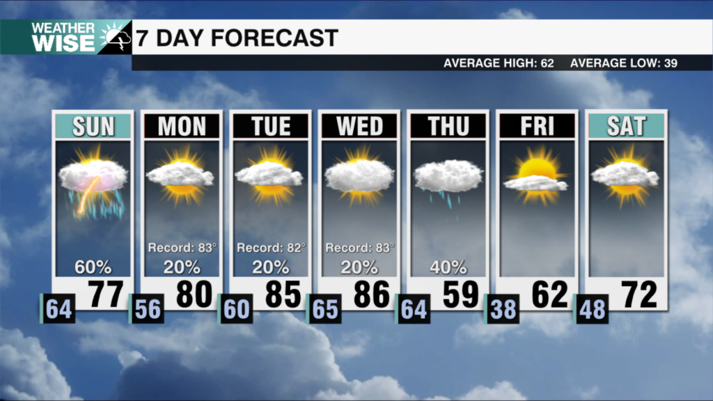
The threat of severe weather continues to increase Saturday night into Sunday morning with damaging wind, tornadoes and localized flooding all possible threats. It is important to get the word out as some of these storms could move in overnight when people are asleep.
Today and Saturday will be warm with highs in the mid to upper 70s. The wind will kick up Satuday with gusts 25-40 mph. The main event for severe weather arrives late Saturday night into Sunday morning as a powerful cold front moves in. This is where we will find a widespread damaging wind threat, embedded isolated tornadoes and localized flooding. However, there is also the potential for isolated storms ahead of the main line — this is where the biggest tornado threat would lie with the biggest threat for areas west of I-77 before daybreak. The severe threat should end by midday, but lingering gusty winds and a few showers will be possible through Sunday evening. Cooler next week with lows in the 40s Monday and highs back in the mid 60s.