Clouds build ahead of late-week rain
Another round of cooler air filters in by the weekend.
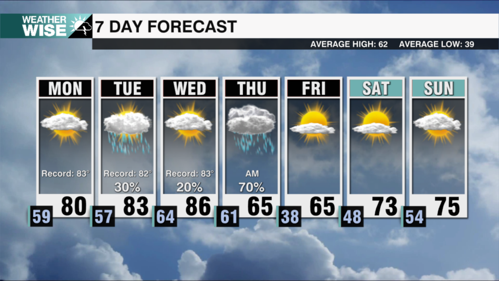
This Wednesday morning was the coldest the Queen City’s seen in over two weeks, but temperatures have recovered nicely into the 50s and 60s this Hump Day afternoon. The return of abundant sunshine is also a lovely sight, but our reunion won’t last long. Clouds will begin to build in across the Carolinas by Thursday morning as another rainmaking system approaches from the northwest. This storm won’t bring us as much rain as Monday’s (1-3″), but most communities can expect at least a half-inch through Friday afternoon.
Expect at least two rounds of rain over the next two days; the first will arrive by Thursday afternoon as a line of showers and storms cruises into the Carolinas. The overall severe threat remains low, but a few cells could pack gusty winds and localized torrential rainfall. The second round arrives overnight and lingers through much of our Friday. While the final day of the workweek won’t be a washout, isolated-to-scattered shower chances and overcast skies will hang around through the afternoon before clearing overnight into Saturday. Any leftover rain may transition to snow in the High Country Friday night as cooler air filters in from the northwest. The weekend looks much like what we saw this Wednesday; chilly mornings with lows in the 20s, 30s, and 40s, and beautiful days with highs in the 50s and 60s.
Tonight: Mostly clear. Chilly. Low: 44º. Wind: SE 5-10.
Thursday: Clouds build. PM scattered showers and storms. High: 70°. Wind: S 5-15. Gusts: 20+
Thursday Night: Mostly cloudy with scattered showers. Low: 54°. Wind: SW 5-10.
Friday: Overcast with scattered showers. Some PM clearing. High: 65°. Wind: NW 5-15.