Warm & unsettled pattern continues
Despite the clouds and rain chances, highs remain near 80° over the next three days.
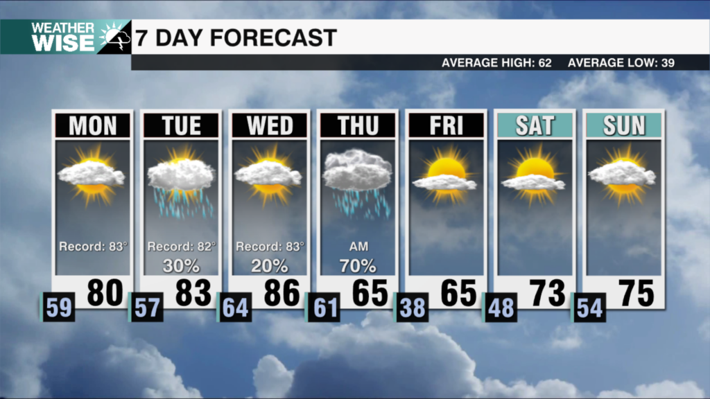
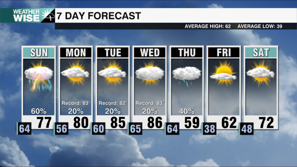
The summer-like feels are in full effect for the final full week of April as temperatures hang near 80° this Wednesday afternoon with rising humidity and pop-up scattered storms. The warm and unsettled pattern continue through the remainder of the workweek as a stalled front slowly collapses over the Carolinas. Despite the increasing clouds and afternoon rain chances, highs will hover near 80° over the next three days.
Our weather prospects finally begin to change on Saturday as a second cold front approaches from the northwest. Expect scattered-to-widespread showers and storms through the first half of the weekend as the system slices through the Carolinas. While models aren’t impressed by the incoming front, we’ll need to watch carefully for heavy, gusty storms later in the day on Saturday. Noticeably cooler and drier air filter in from the northwest on Sunday as highs dip slightly below average in the 60s and 70s. Temperatures quickly recover into next week, but rain chances appear few and far between beyond this coming weekend.
Tonight: Mostly cloudy with a few showers. Low: 63º. Wind: E 5-10.
Thursday: Variable clouds. PM scattered storms. High: 78°. Wind: E 5-10.
Thursday Night: Overcast with a few showers. Low: 63°. Wind: Light.
Friday: Mostly cloudy with PM scattered storms. High: 78°. Wind: S 5-10.