WeatherWise Alert: Strong to severe storms possible overnight
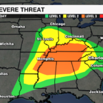
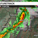
A cold front will trigger a line of storms that will track through the Tennessee Valley and into the Carolinas tonight. Although the cold front will be tracking into the region after midnight, the atmosphere will be primed due to the warm, moist air in place due to a boundary lifting north ahead of the cold front. This boundary will spark a few showers and storms after 7 p.m. An isolated storm, or two could be strong with gusty winds, or hail. However, the severe threat will be greatest within the line of storms tracking out of Tennessee overnight.

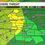
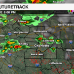
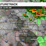
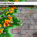
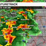
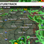
The severe threat will peak in the mountains with the arrival of the line of storms between 12 a.m. – 2 a.m. Wednesday. This line will likely reach the Piedmont between 2 a.m. – 4 a.m., before weakening east of I-77. The majority of showers and storms will clear the area before sunrise.

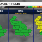
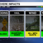
BIGGEST THREATS:
- Damaging Wind – Main Threat – Gusts could reach up to 60 mph
- Hail – Quarter+ Sized
- Isolated Tornadoes – while the threat is low, a brief tornado can’t be ruled out.
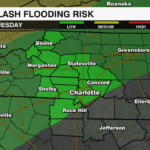
- Localized Flooding – due to heavy downpours within the main line
Once the front pushes through, cooler and drier air will filter in, leading to a significant drop in humidity. Temperatures will be well below average with gusty northwest winds Wednesday night into Thursday, before dying down ahead of the Memorial Day Weekend.
Make sure you have multiple ways to receive weather alerts. Download the WCCB Weather App for the latest information on tonight’s storms.


