Rain returns before summer rushes back into the forecast
Signs of normalcy on the horizon
If you were confused when you walked out the door today and noticed a strange glowing orb in the sky, you’re not alone. The sun made a welcome return to the Queen City today as a beautiful start to the weekend kicked off. Unfortunately, don’t get too used to it as clouds and rain return tomorrow and last through Monday. Tomorrow looks pretty cloudy area wide with rain chances running high MAINLY south of I-85. It looks like the city sees isolated showers, areas to the south see widespread showers, especially by the evening hours. To the north, rain chances are less likely with a couple showers at times. By Monday, rain looks much more widespread across the WCCB Charlotte viewing area. This keeps temperature around 80 in the Piedmont over the next 2 days, and topping out around 75 in the High Country.
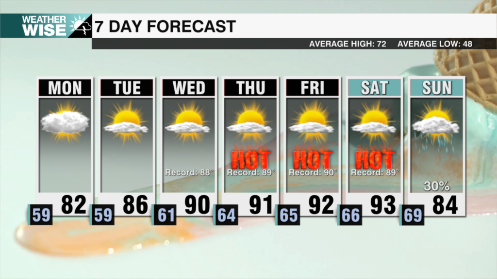
The good news is more typical summer weather, including sunshine returns as the week goes on. Temperatures will start to rise back into the upper 80s and lower 90s by Wednesday. This also means we will have the chance for a couple of afternoon storms all week, but I don’t see any washouts after Monday! Highs in the High Country look to get back to 80 in that same timeframe.
Elsewhere, we are watching a new area in the Atlantic that has a high probability of taking the name Erin. The good news is this storm is still more than a week away from the United States if it even gets that far. Most model guidance suggests this potential storm curving back out to sea before reaching the lower 48. With that said, come back for more as the week goes on as we fine tune that forecast!
Tonight: Increasing Clouds. A stray shower south of I-85. Low: 68°. Wind: NE 5 mph
Sunday: Cloudy. Showers likely south of I-85. High 80°. Wind: E 5-10 mph
Sunday Night: Mostly Cloudy. Scattered Showers. Low: 69°. Wind: E 5-10 mph
Monday: Rain Likely. High 79°. Wind NE 5-10 mph