Near record warm temperatures on the horizon
Tracking a major temperature climb
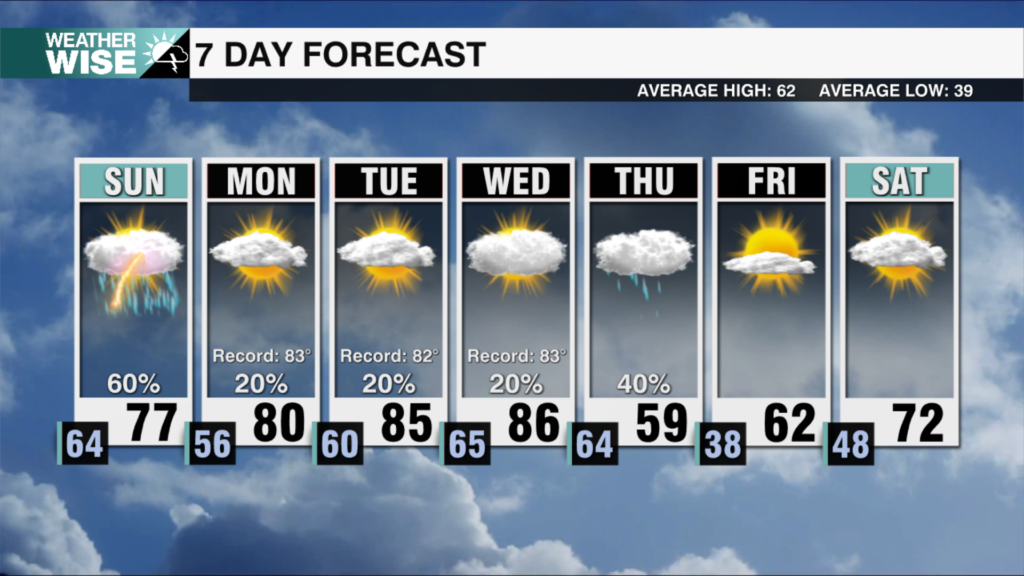
After a dreary Saturday, big changes are on the way. The low pressure system responsible for the limited rain today is beginning to move out and sunshine will return tomorrow. I would watch for some patchy dense fog overnight, but it will quickly wane once the sun rises tomorrow. Tomorrow will be a beautiful January day with ample sun and temperatures in the mid 50s in the Piedmont and mid 40s in the High Country. From here things turn abnormal as a steady warm up commences.
By Monday we begin to approach 60 with winds returning from the south. The trend continues with each day warmer than the previous through Wednesday. By Wednesday we could find temperatures in the 70s for some with the potential to break daily temperature records. This is 20 degrees above average for early January! The warm up looks to level off by Thursday as clouds increase, but we will still be well into the 60s, and flirting with 70 for some. Now through Thursday looks dry across the region, but that likely changes sometime between Friday and Saturday of next week. This will be thanks to an approaching storm system that will also likely end our warm streak in the 7-10 day range.
As always stay tuned to the WCCB weather team for the latest!
Tonight: Clearing skies. Low: 33°. Wind: NE 5
Sunday: Sunny. High 57°. Wind: Calm
Sunday Night: Increasing Clouds. Low: 36°. Wind: Calm
Monday:Mostly sunny. High 59°. Wind: SW 5-10