April heat wave arrives this week
Tracking record heat and drought
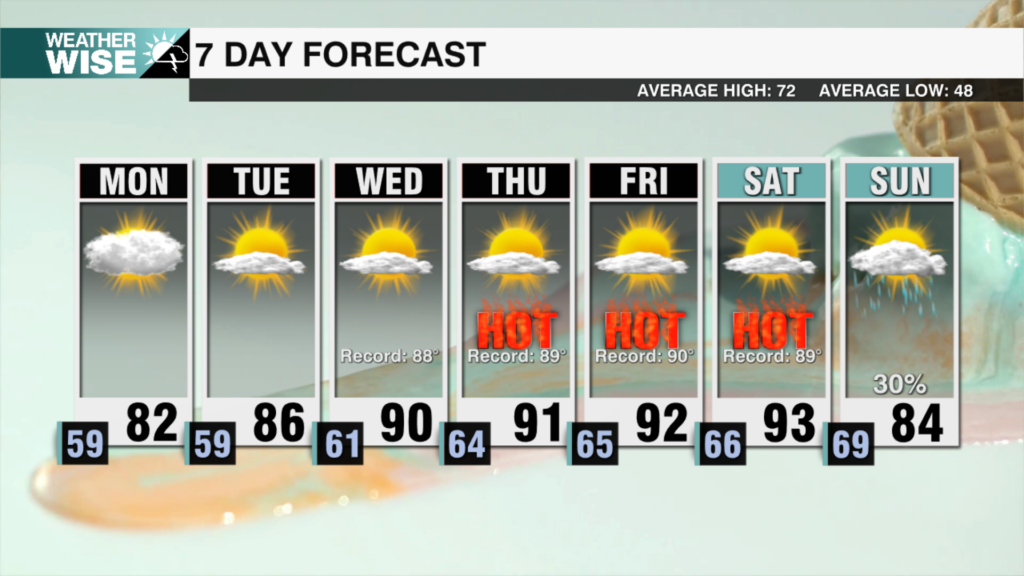
An April heat wave is on the way to the Carolinas as a dome of high pressure parks itself over the region. Monday will continue the trend of above average temperatures with highs in the low 80s in the Piedmont. These temperatures will be accompanied by mostly cloudy skies, helping to keep highs from record levels. By Tuesday, mostly sunny skies return and highs reach the mid 80s.
The middle of the week is where we go from unusually warm to record-breaking levels of heat. Wednesday has a shot to be the first 90 degree day of 2026 with 90+ degree highs lasting through Saturday with ample sunshine. This will likely break multiple daily high temperature records and could go down as one of the most impressive April heat waves in Charlotte history!
The biggest problem here is the lack of rainfall. In fact, this dome of high pressure will prevent any rainfall through Saturday at least. This is problematic as ongoing drought conditions are turning from bad to worse. This stretch of record heat and low humidity will only make things worse. Make sure to conserve water as you start planting by watering in the morning or evening while the sun angle is low. Also, remember the wildfire risk is very high right now and a statewide burn ban continues. Stay hydrated, and make sure to be fire conscious this week!
Sunday Night: Mostly clear. Low: 59°. Wind: S 5-10
Monday: Mostly cloudy. High: 82°. Wind: SW 5-10
Monday Night: Mostly clear. Low: 59°. Wind: SW 5
Tuesday: Mostly sunny. High: 86°. Wind: SW 5-10