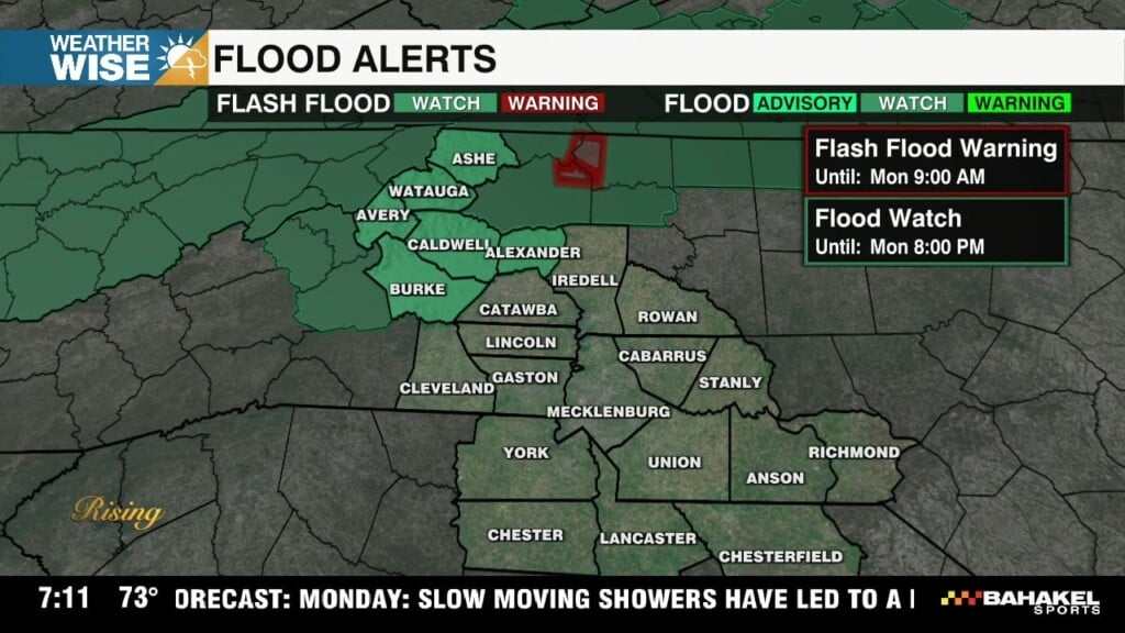
Severe Threat Monday: Timing and Impacts
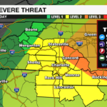

Level 2 – Medium Severe Threat Level

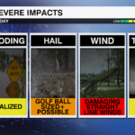
WHAT: Supercells and a cluster of thunderstorms will be capable of producing severe weather including damaging wind, large hail, isolated tornadoes, and localized flooding this afternoon and evening across the region.
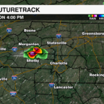
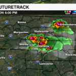
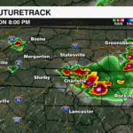
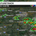
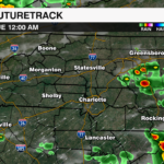
TIMING: 4PM – 12AM
WHERE: Areawide. Severe hail threat highest across the foothills and Piedmont

THREATS:
- Damaging Straight Line Winds — Primary Threat
- Large Hail (larger than golf ball sized) — Primary Threat
- Isolated Tornadoes
- Localized Flooding
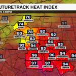
Although there are clouds and patchy showers across the region this morning, all will fade over the next few hours with sunny skies and high heat this afternoon as highs soar to near 90 degrees. Tropical moisture will lead to surface dew points near 70 degrees.
Models have nudged the development of these storms toward mid to late afternoon during peak daytime heating.
A cold front will trigger thunderstorms across the region this afternoon. The storm prediction center has highlighted much of the WCCB viewing area under a level 2 or 3 (out of 5). The biggest concern will be damaging wind and large hail as a cluster of thunderstorms develops and expands east into a broken line of thunderstorms through the evening. Supercells will also be a concern earlier in the afternoon and embedded within any lines of storms that develop. This is where there would be the highest potential of a brief tornado. Moisture will be abundant and localized flooding will also need to be monitored as storms could produce intense rainfall rates.
Once the cold front clears the area tonight, the severe threat will end.
Download the WCCB Weather App for the latest updates on the severe threat from the WeatherWise team.