Record highs possible Thursday
Isolated severe storms possible Friday and Saturday
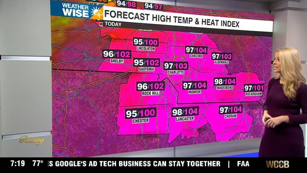
Heat Advisory in effect for Union, Anson and Richmond counties from 11 am to 8 pm.
A Slight Risk (level 2 of 5) is in place for Saturday. This means isolated severe storms are possible. Damaging wind gusts and large hail will be the primary threats.
Forecast:
Thursday: Dangerously hot again with highs closing in on 100. Forecasting 98. “Feeling like 103-106. Our record for the day 98 set in 1925. We could tie or break that.
Friday: Hot! Highs in the upper 90s. Isolated showers and storms. Isolated storms could produce damaging wind gusts and small hail.
Saturday: Highs in the mid 90s. Scattered showers and storms. A couple storms could become severe. Damaging wind is the main threat.
Sunday: “Cooler” but really just back to average. Highs in the mid to upper 80s. Scattered showers and storms.
Labor Day: Partly sunny. Highs in the mid 80s.
Next week: Temperatures gradually rising with 90s returning midweek.
Have a great day and stay cool!
Kaitlin