Warm Friday, rain chances trending up Sunday
Cooler and more unsettled beginning Tuesday
Forecast:
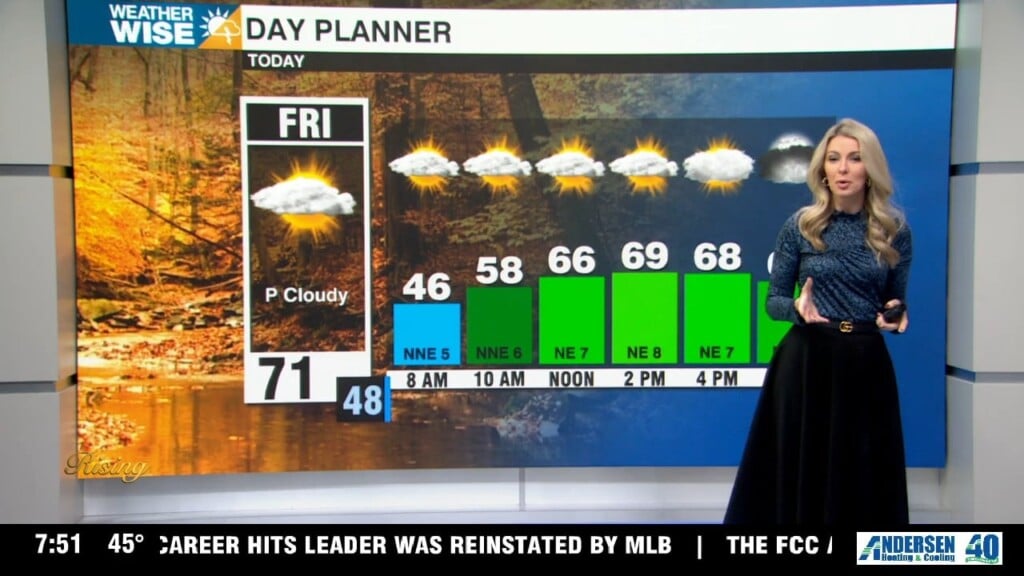
Friday: Nice and warm with more clouds. Highs near 70.
This weekend: Rain chances increase late Saturday into Sunday as a low pressure moves up the coast. Rain chances depend on the track of the low. If this low pressure shifts farther east (what the GFS is showing) than most of us will miss out on the rain. If it shifts farther west (what the euro is showing) more of us will see rain. The farther east in the Carolinas you are, the higher the rain chance.
The National Hurricane Center is giving this a medium chance of tropical formation right now – regardless of any tropical development, impacts don’t change. Strong winds, highs seas and surf, possible flooding and erosion to the Outer Banks. The next name on the list is Kyle.
Saturday: More clouds, but likely dry. Highs in the low 60s. A few showers could move in after midnight.
Sunday: Possible morning showers – depends on the track of the coastal low pressure. Highs in the mid 60s.
Monday: Definitely the nicest day of the week as temperatures push the low 70s ahead of a cold front.
Tuesday: Much cooler air spills into the area. Isolated showers are possible with highs in the 50s.
Wednesday and Thanksgiving: It is still early but right now scattered showers and cold temperatures look to dominate the holiday. Highs will be in the 40s and 50s with rain likely.
Have a great weekend!
Kaitlin