Much Needed Rain Heading Toward the Carolinas
AM Headlines:
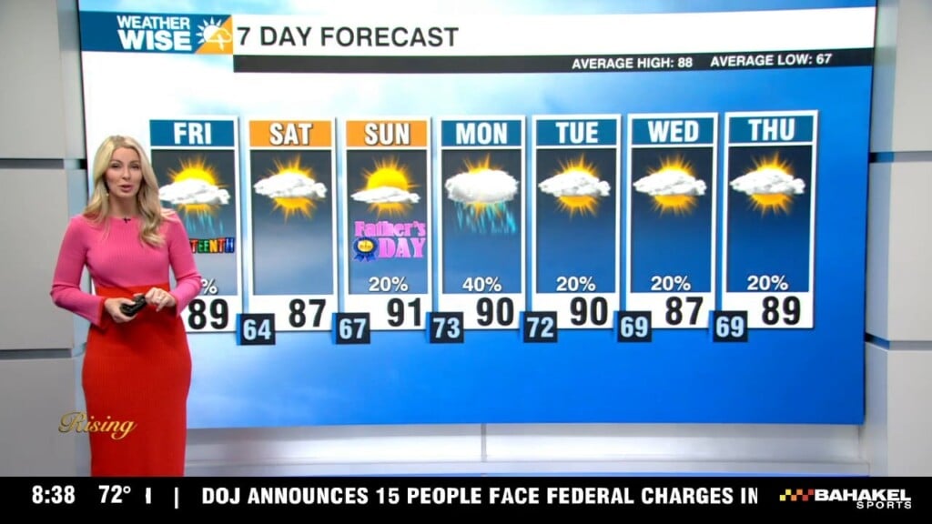
- Afternoon showers/isolated storms
- Seasonable temps through the end of the week
- Swampy feels when it’s not raining
- Heating up for the weekend
Discussion:
A boundary will be bringing showers and storms back to the area beginning this afternoon. You’ll begin to notice more of those Carolina swampy feel as moisture returns to the area. Highs will reach the low to mid-80s with overnight lows falling into the mid-60s. This system will move through at a snail’s space giving us widespread showers and a few thunderstorms Thursday through Friday. At times we could be dealing with very heavy downpours. Although it has been dry, any areas that get trained over with these heavy downpours could deal with a localized flooding threat. However, a widespread threat for flooding is not likely. 1-2″ of rainfall won’t end the drought, but it will certainly help.
This cold front will move off the Carolina coast this weekend, bringing more wet weather to the coast for anyone who has weekend beach plans. Temps will warm into the upper 80s beginning Sunday into early next week as a new pattern sets up, bringing on the chance for afternoon and early evening storms.