Severe Weather Preparedness Week: Flooding
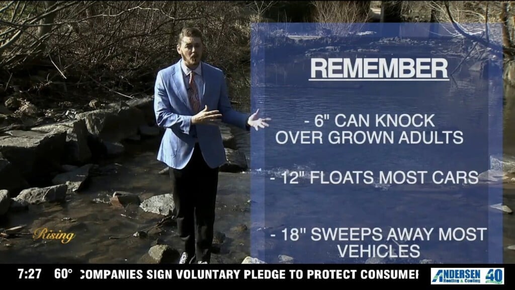
We say it all the time: turn around, don’t drown. That’s for good reason - the #1 cause of avoidable death from severe weather in the Carolinas is drivers trying to make it through flooded roadways.

We say it all the time: turn around, don’t drown. That’s for good reason - the #1 cause of avoidable death from severe weather in the Carolinas is drivers trying to make it through flooded roadways.

Meteorologist James Scott spoke with Dr. Sanjay Khiani on how to keep from sneezin' this season.

Gretchen be fetchin' - and she has so much love to give! Learn more about this sweet baby girl HERE.
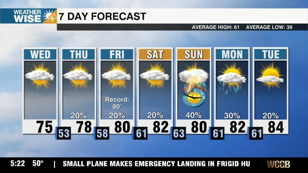
Highs near 80° paired with rising rain chances and humidity levels will make March's first full weekend feel more like May.
The warmest stretch we've seen in nearly six months is just around the corner.
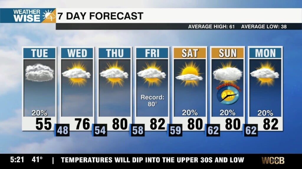
A classic cold air damming setup continues this Tuesday afternoon, but the warmest stretch we've seen since September 2025 picks up by Thursday.
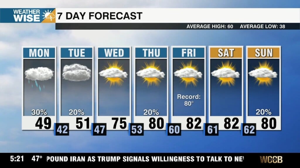
A classic Carolina Wedge kicks off March's first workweek, but multiple days in the 80s lie ahead as we roll into the weekend.

Two Monroe police officers in the hospital following a traffic collision on Highway 74 Friday morning
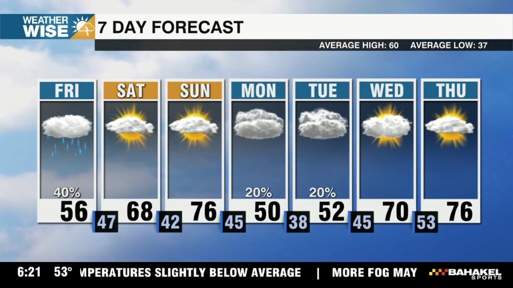
Clouds and fog will keep temperatures slightly below average for our final day of the workweek, but highs quickly rise back into the mid-70s on Sunday.

Life’s a Beech… and North America’s tallest town east of the Rockies (5,506') has been playing in the snow this winter. About five feet of it, actually.
 Formerly Twitter