Summer chugs ahead, Erin draws closer to Carolinas
Clouds will do their best to keep the Queen City below 90Β° this Tuesday afternoon, but any meaningful cooldown doesn't arrive until Friday at the earliest.
Sections
WCCB
Extras

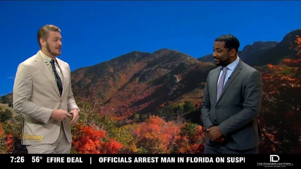
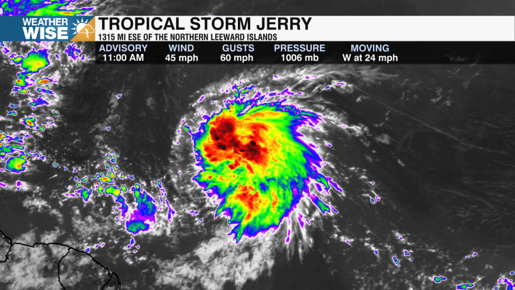
James Scott is the weekday morning meteorologist for WCCB News Rising, a position heβs held since June 2025. James worked as WCCB’s weekend meteorologist for the previous six years.
Born and raised in Chapel Hill, NC, James attended Carrboro High School and graduated in 2014. After playing a year of prep basketball at Hargrave Military Academy in Chatham, VA, he found that college basketball wasnβt in the cards for him and decided to focus on his true passion: meteorology.
James immersed himself in the wide world of weather at North Carolina State University (Go Pack!). He quickly joined the weather broadcast club but struggled at first and was unsure if TV was the right field for him to be in. That all changed, however, after his first internship at WECT in Wilmington, NC. James was taught and inspired by the weather team there, which renewed his passion for broadcast meteorology. The next summer, he interned at KARE in Minneapolis, MN, which only deepened his love for broadcasting. The 18 hours of sunlight per day did mess up his sleeping patterns, however. By the time he graduated, he became the president of the broadcast club at NC State and was ready to become Charlotteβs newest meteorologist.
James is an avid sports watcher, whether it be professional or college. He loves the Miami Heat, Philadelphia Eagles, Boston Red Sox, Carolina Hurricanes, and his beloved NC State Wolfpack. Heβs always down for a game of basketball, so message him for a challenge. Give him a like on Facebook and follow him on Twitter @JamesWCCB!
Clouds will do their best to keep the Queen City below 90Β° this Tuesday afternoon, but any meaningful cooldown doesn't arrive until Friday at the earliest.
Highs rise into the 90s for a fourth-straight day around the Metro on Monday, but significantly cooler air arrives by the end of the week.
After undergoing rapid strengthening overnight Friday into Saturday, Hurricane Erin is now a Category 5 storm with core winds approaching 160 mph.
Erin strengthened into a hurricane on Friday as it approached the northeast Caribbean, prompting forecasters to warn of possible flooding and landslides.
Sunny skies and toasty highs are back in the driver's seat across the Carolinas this weekend.
Showers and thunderstorms reign supreme again this Thursday, but a more stable air mass settles into the Carolinas this weekend.
Charlotte hasn't cracked 90Β° in nearly two weeks, but our cooler stretch is running out of real estate.
Scattered showers and overcast skies keep highs in the 80s for now, but summer cranks up the thermostat again by the end of the week.
Tropical Storm Erin formed Monday morning in the eastern Atlantic Ocean and forecasters expect it to become the first hurricane of the Atlantic season this week.
Clouds and scattered showers keep the below-average temperatures around for now, but summer surges back into the Carolinas later this week.
icons go here