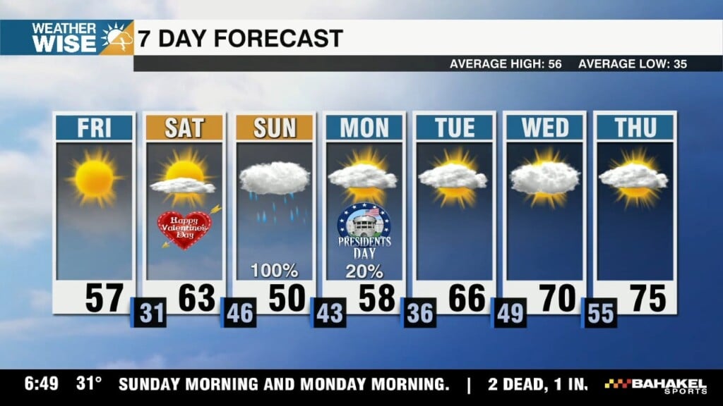
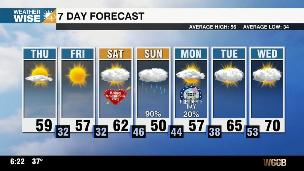
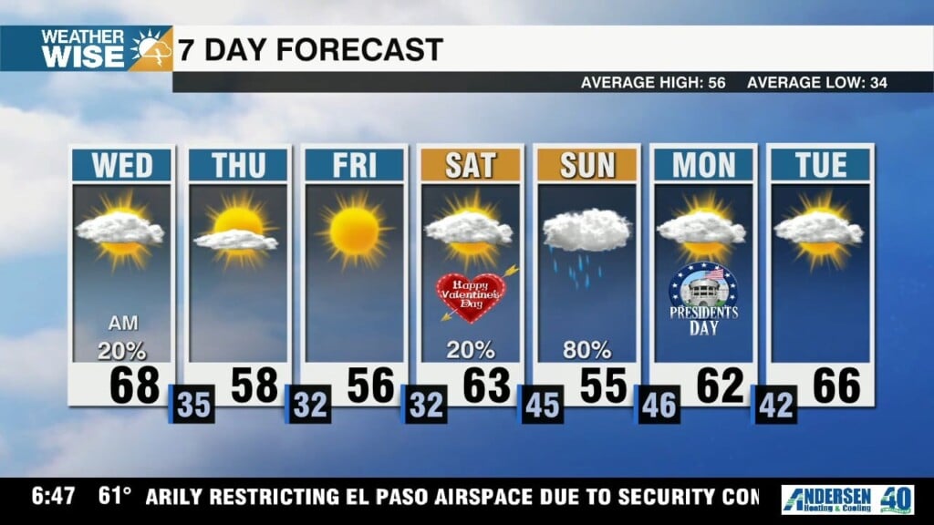
Lovely start to Valentine’s Day weekend, widespread rain lurks Sunday
You can set your heart on a beautiful Valentine's Day Saturday, but we're in for a good soaking on Sunday.

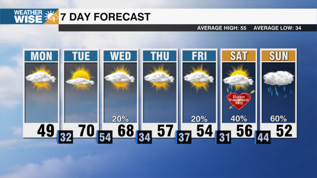
You can set your heart on a beautiful Valentine's Day Saturday, but we're in for a good soaking on Sunday.
While cooler air prevails to close out the workweek, plentiful sunshine will make spending time outdoors much more tolerable.
Temperatures remain near/above average into the weekend, but we'll fall well short of Tuesday's 73° high as we close out the workweek.
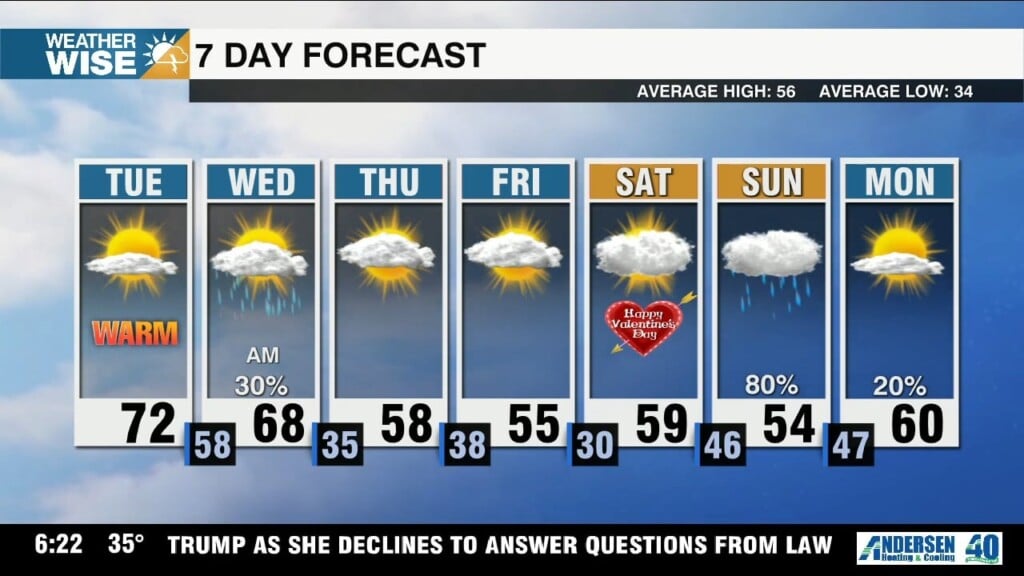
The warmest stretch we've seen in a month starts today, but increasing rain chances may break a few hearts this Valentine's Day weekend.
Highs struggle to clear the 20s and 30s this Monday afternoon before the coldest air we've seen since Christmas 2022 arrives tonight.
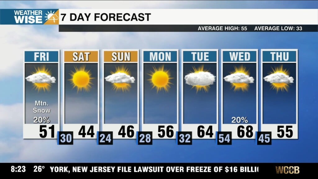
The warmest air Charlotte has seen in two weeks settles in today, but jet-stream-enhanced snow rolls into the High Country this afternoon.
Many Piedmont & Foothills locations reach 50° for the first time in two weeks on Friday, but potentially heavy snow rolls into the mountains as we close out the workweek.
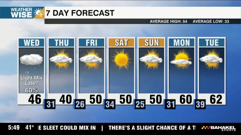
Scattered rain showers this afternoon may lead to a light wintry mix for some along & north of I-85 overnight.
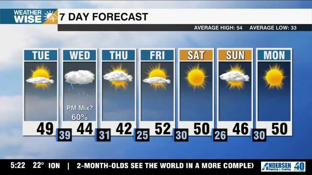
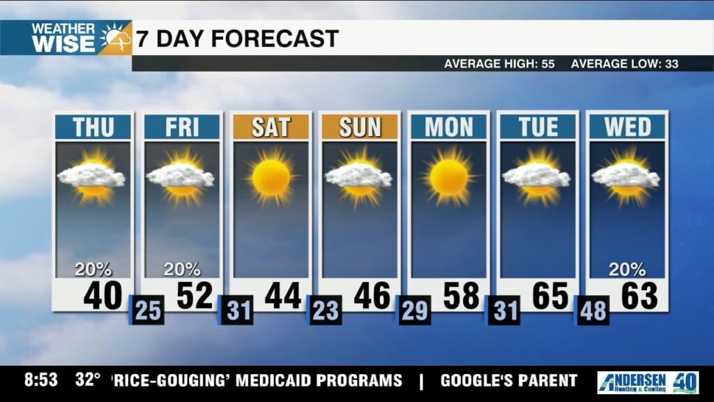
Another bout of wintry weather is possible Wednesday overnight into Thursday, but it won't amount to much - if anything at all.
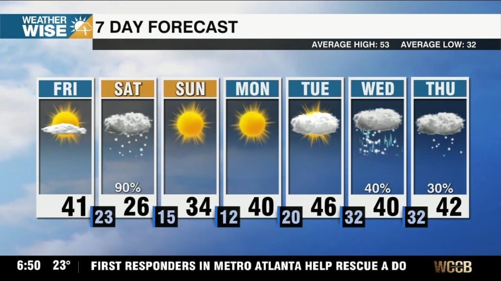
Scattered snow showers begin in the High Country this Friday evening before spreading across the Foothills & Piedmont overnight into Saturday.
 Formerly Twitter