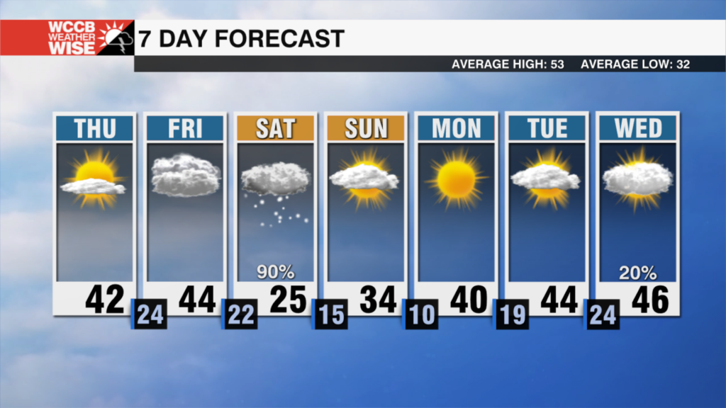
Snow chances rise into weekend
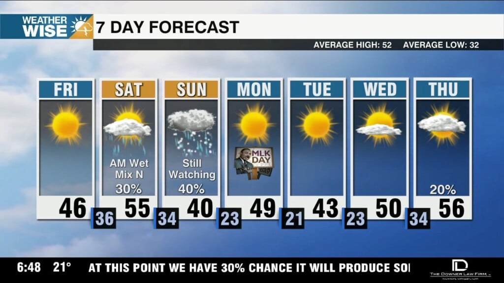
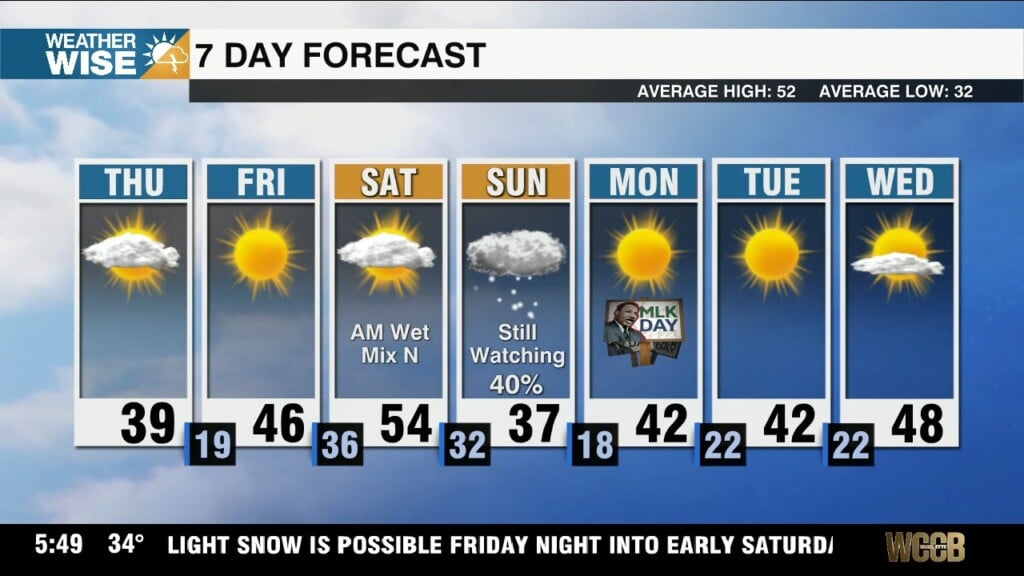
The Carolinas remain dry through Thursday, but snow chances begin to pick up by Friday's end - and significant totals are on the table for many.

The Carolinas remain dry through Thursday, but snow chances begin to pick up by Friday's end - and significant totals are on the table for many.
Highs remain below average through the remainder of the workweek as snow chances trend upward this weekend.
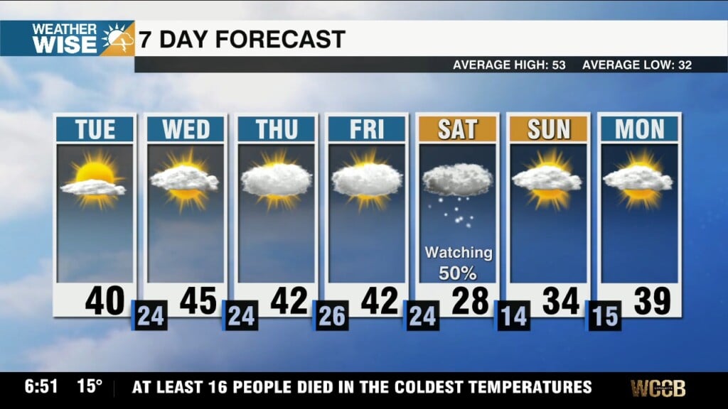
Temperatures become a bit more tolerable after the coldest air we've seen in over three years, but another potential winter storm looms this weekend.
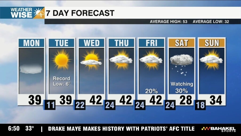
Highs struggle to clear the 20s and 30s this Monday afternoon before the coldest air we've seen since Christmas 2022 arrives tonight.
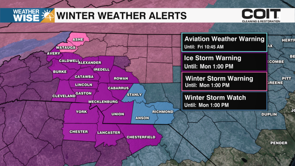
Power outages and hazardous road conditions continue across the viewing area as conditions are expected to worsen this evening.
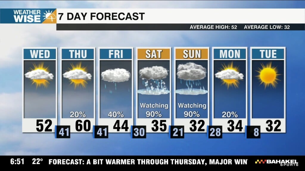
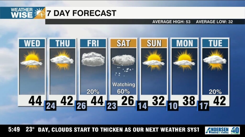
Highs swell near 60° on Thursday, but any warm-up will be short-lived as a major winter storm sweeps across the country this weekend.
Highs rise near 60° around the Metro by Thursday, but another major cold snap will set the stage for a high-impact winter storm this weekend.
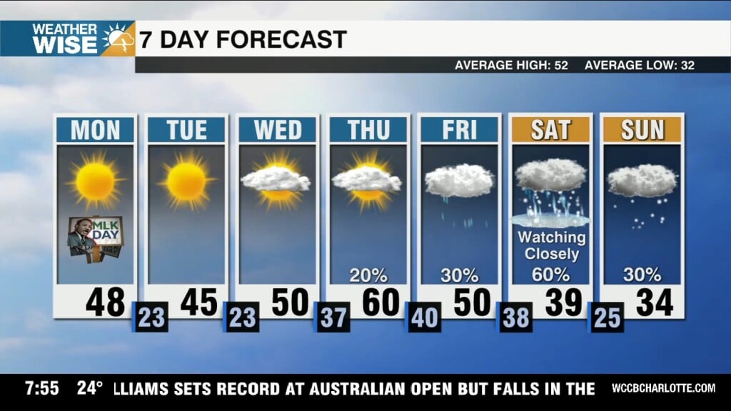
Highs struggle to clear the 30s and 40s over the next two afternoons before rebounding near 60° on Thursday, but the warm-up won't last long.
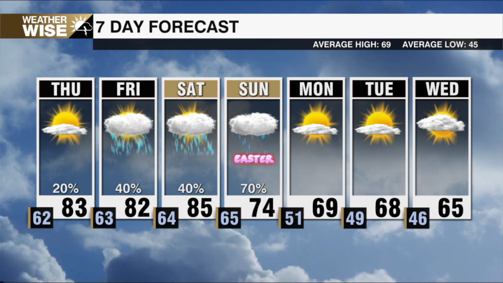
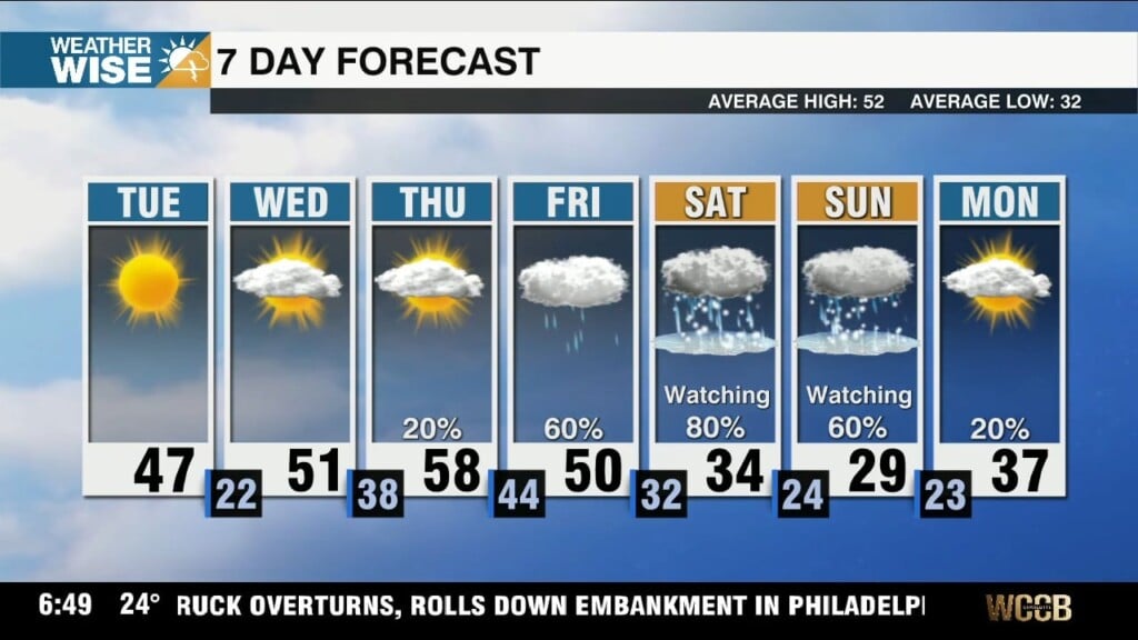
Keep your expectations tempered, but we'll be watching for rain and snow showers over the holiday weekend.
Highs struggle to clear the teens, 20s, and 30s this Thursday afternoon as the coldest air we've seen so far in 2026 arrives overnight.
 Formerly Twitter