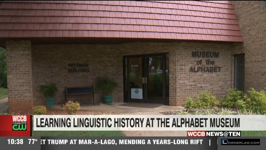
Learning Linguistic History At The Alphabet Museum
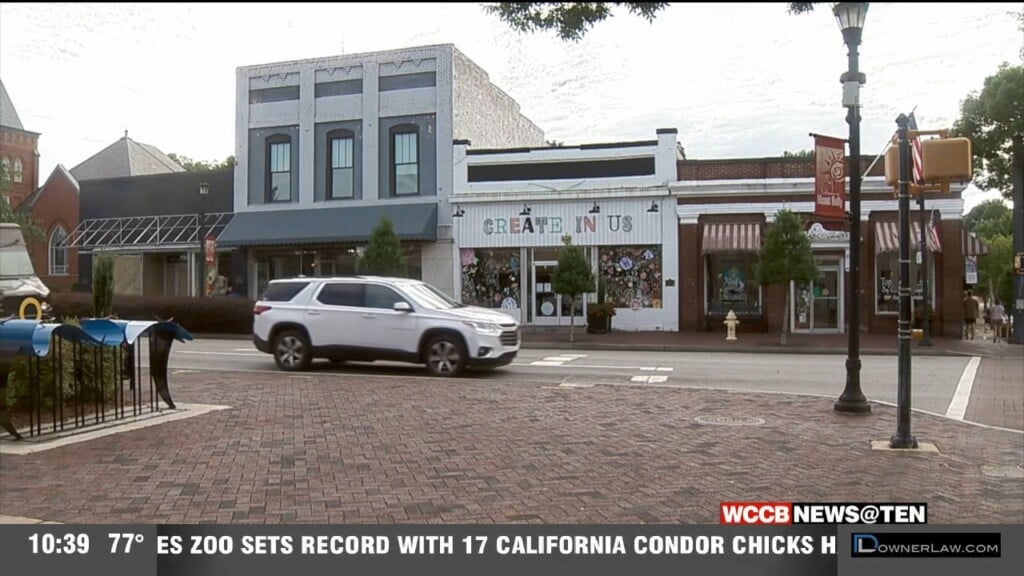
Many residents feel that they have found something special in the southwestern corner of Union County.

Many residents feel that they have found something special in the southwestern corner of Union County.
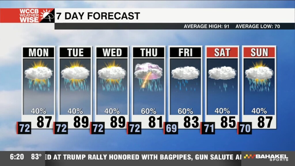
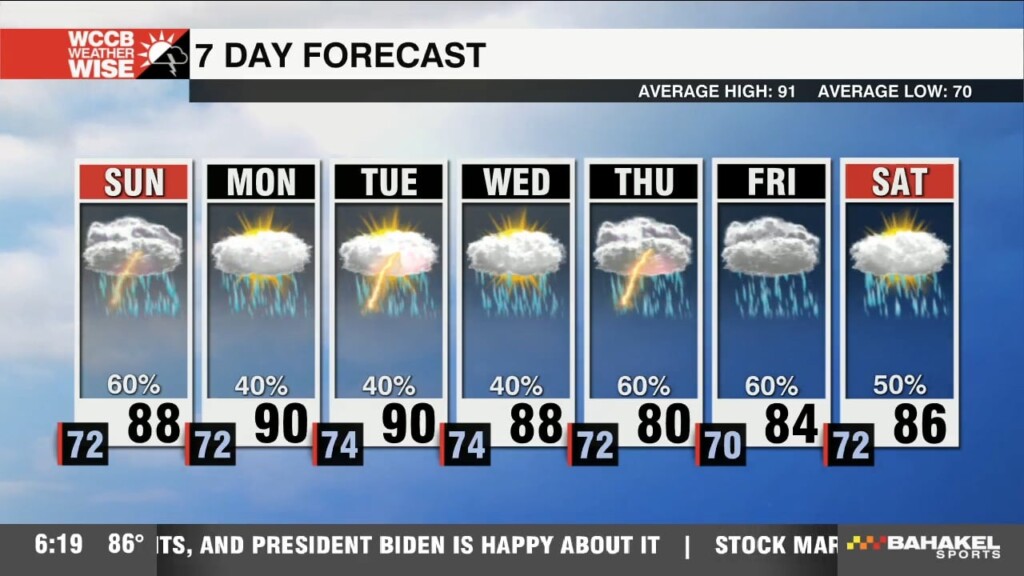
After a beautiful final weekend of July, weather befitting for a Monday arrives to start the workweek.
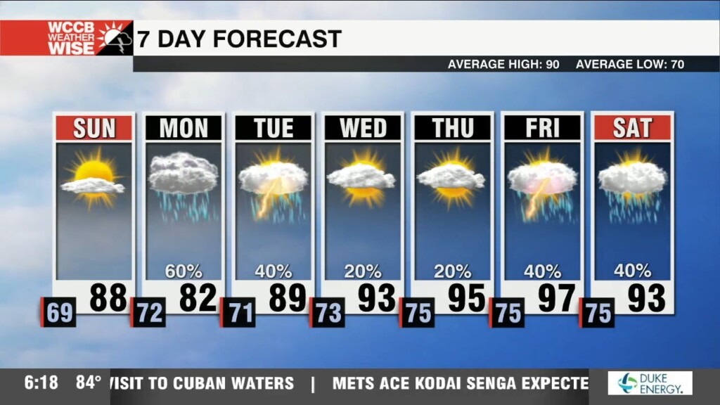
We'll be putting the "sun" in Sunday before another messy pattern reclaims the Carolinas to start the workweek.
The Veteran’s Park expansion plan is an ambitious project to revitalize downtown, complete with an amphitheater, splash pad, shopping district, and mixed-use residential buildings.
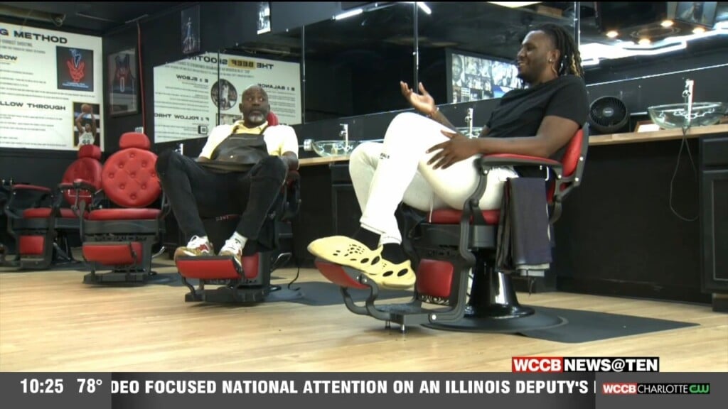
Former Wofford and South Carolina basketball star BJ Mack is off to continue his career overseas, but he’s helping his father, Brian, start his own dream in the Queen City.
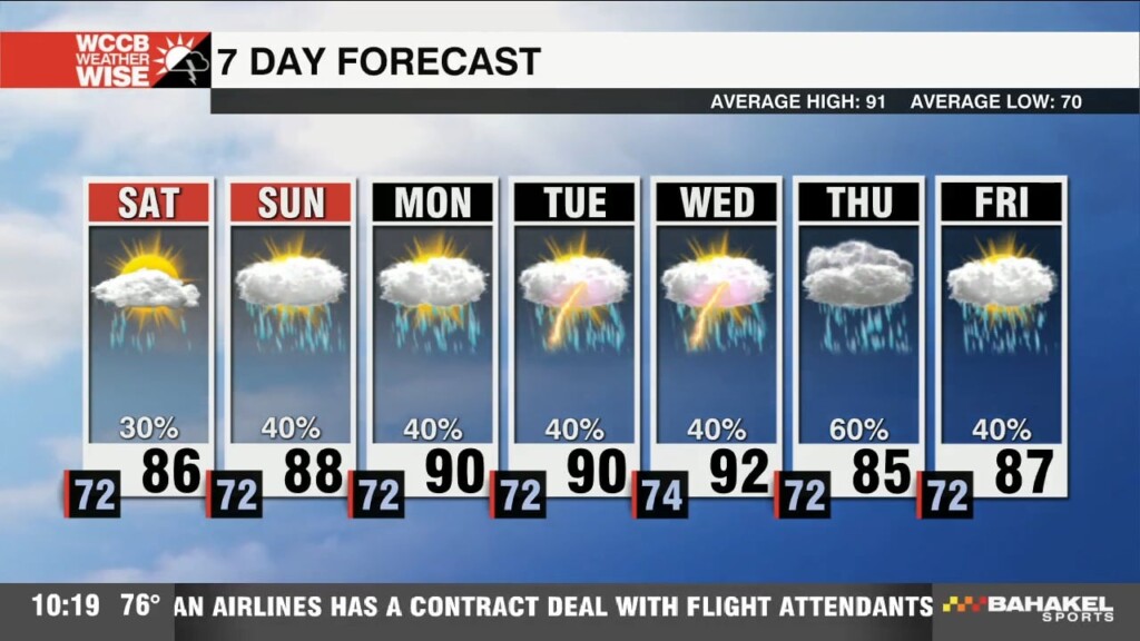
We're heading into a new week, but the forecast is showing the same thing: heat and humidity with a side of afternoon storms.
No single day ahead will be a washout, but we'll want to stay weather-wise for scattered heavy storms over the next several afternoons.
While it won't exactly feel like fall, below-average temperatures and above-average rain chances carry through Sunday.
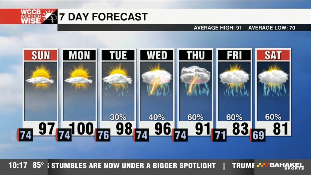
Temperatures come awfully close to the triple digits over the next two afternoons.
 Formerly Twitter