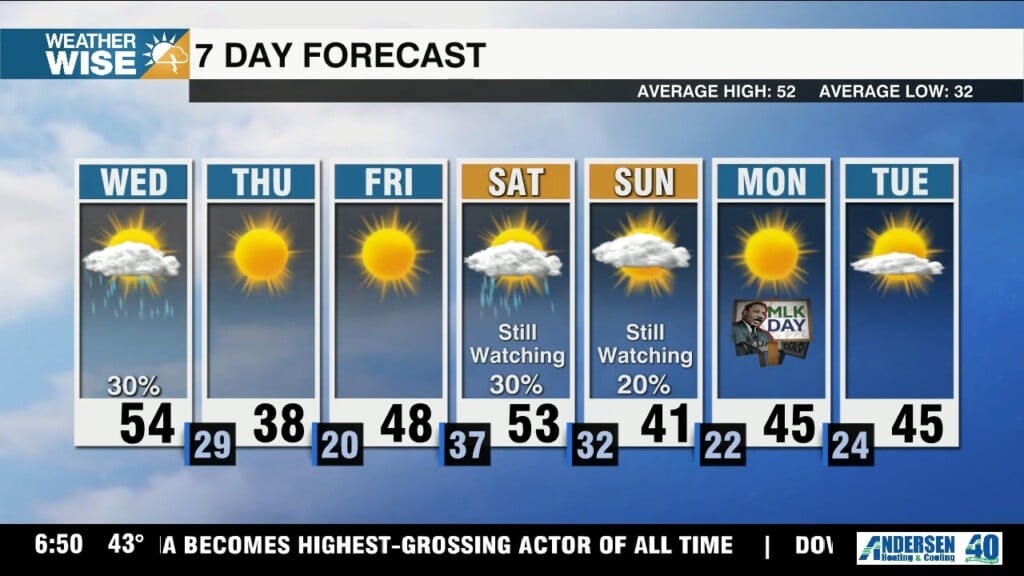
Few showers Wednesday, windy & cold into weekend
An incoming cold front brings a few showers into the Carolinas this Wednesday afternoon, but the bigger story will be the frigid air it leaves in its wake.

An incoming cold front brings a few showers into the Carolinas this Wednesday afternoon, but the bigger story will be the frigid air it leaves in its wake.
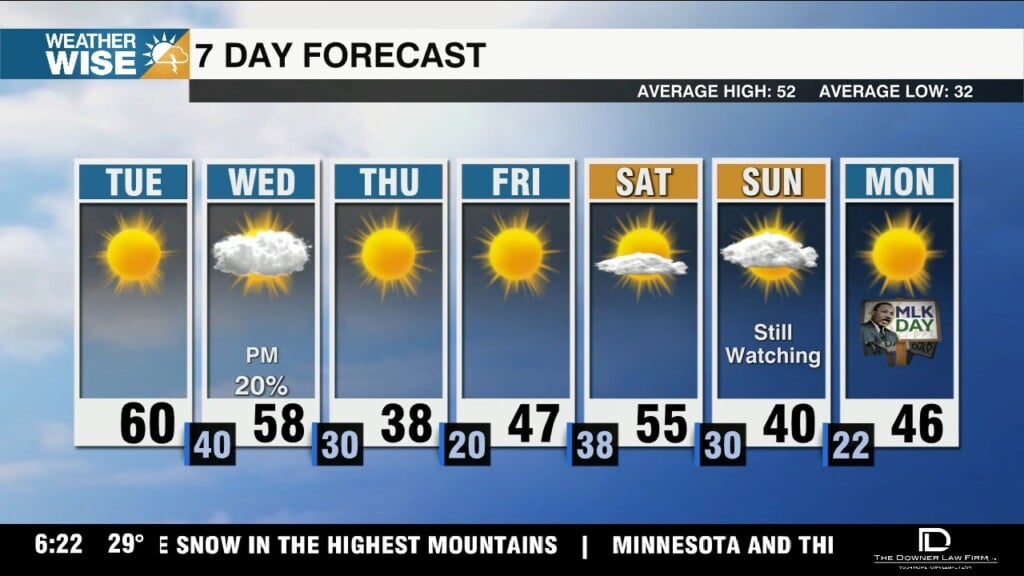
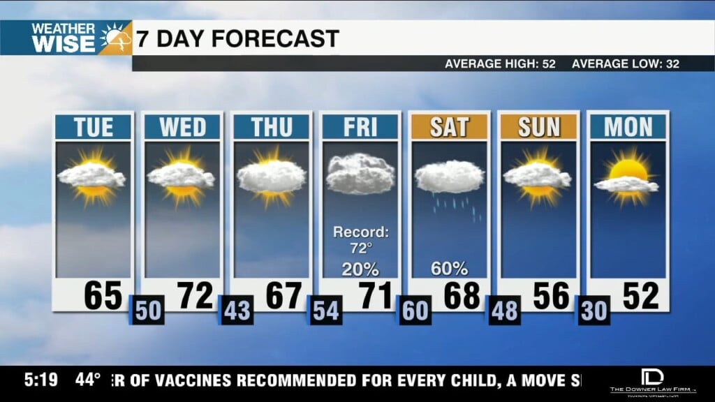
Sunny skies and stiff southwesterly winds will fuel highs near 60° through Wednesday before the bottom falls out later this week.
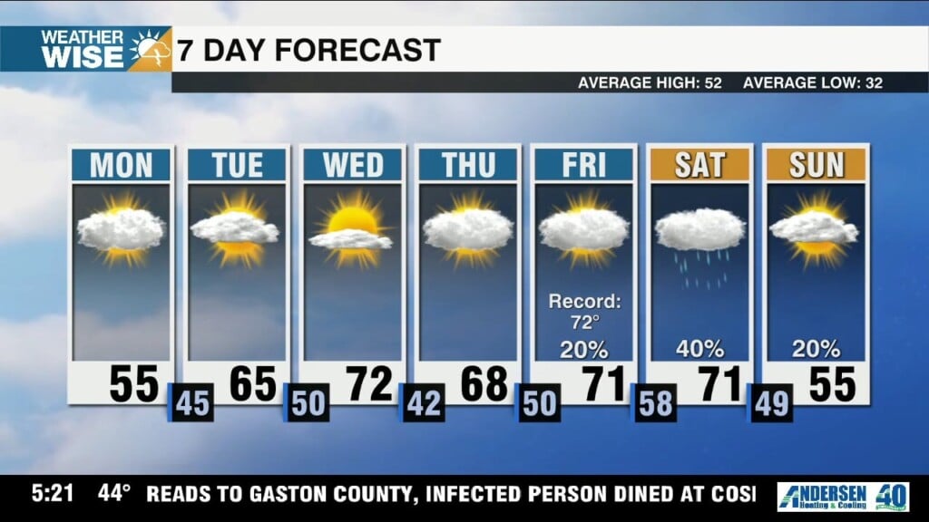
Temperatures quickly rebound near 60° by Tuesday afternoon, but winter weather fans will want to keep a close eye on the back half of the week.
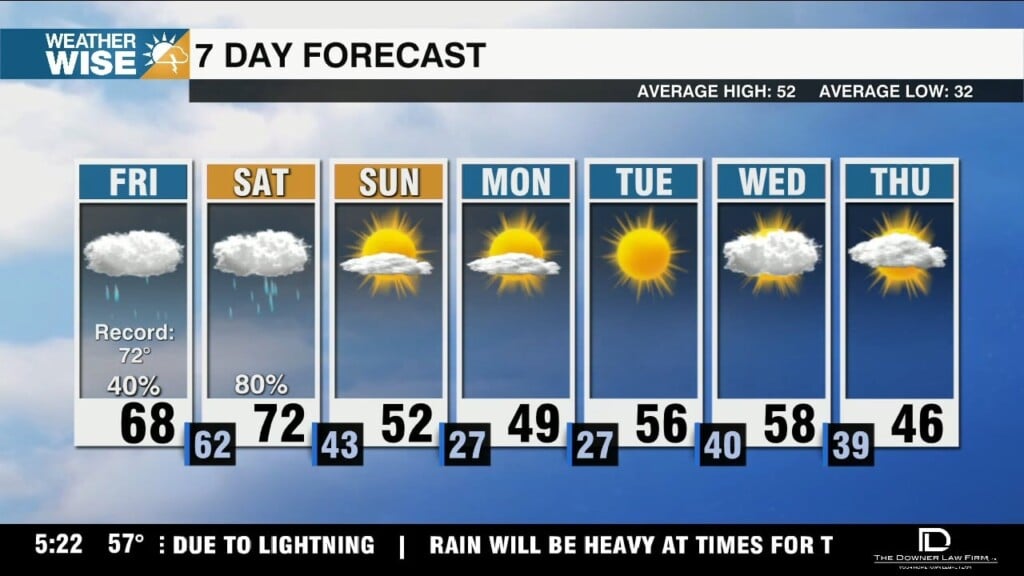
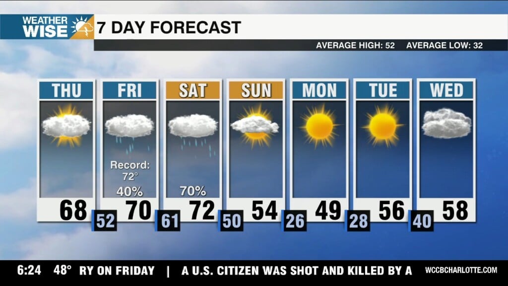
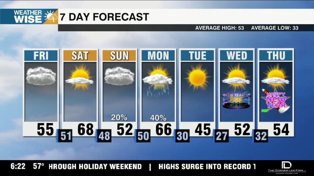
Temperatures approach record territory this Friday afternoon despite overcast skies and scattered showers.
Enjoy today's sunshine while it lasts! Clouds and rain chances build into the weekend.
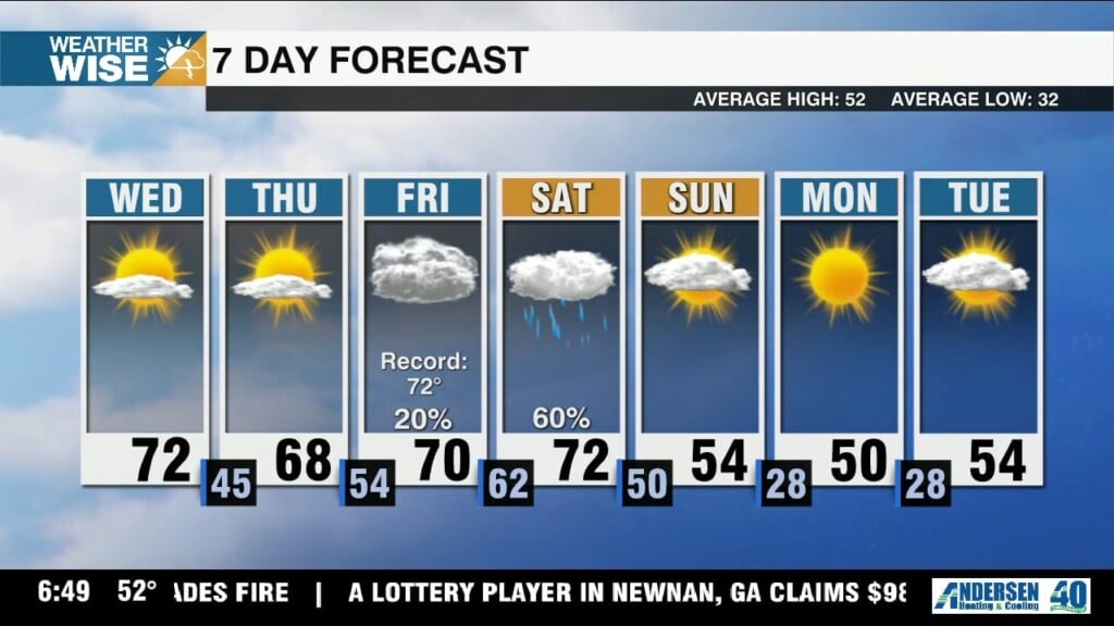
Highs swell into the 70s across the Piedmont and Foothills this Wednesday afternoon and remain well above average into the weekend.
We're picking up where Christmas left off as near-record highs surge into the Carolinas this week.
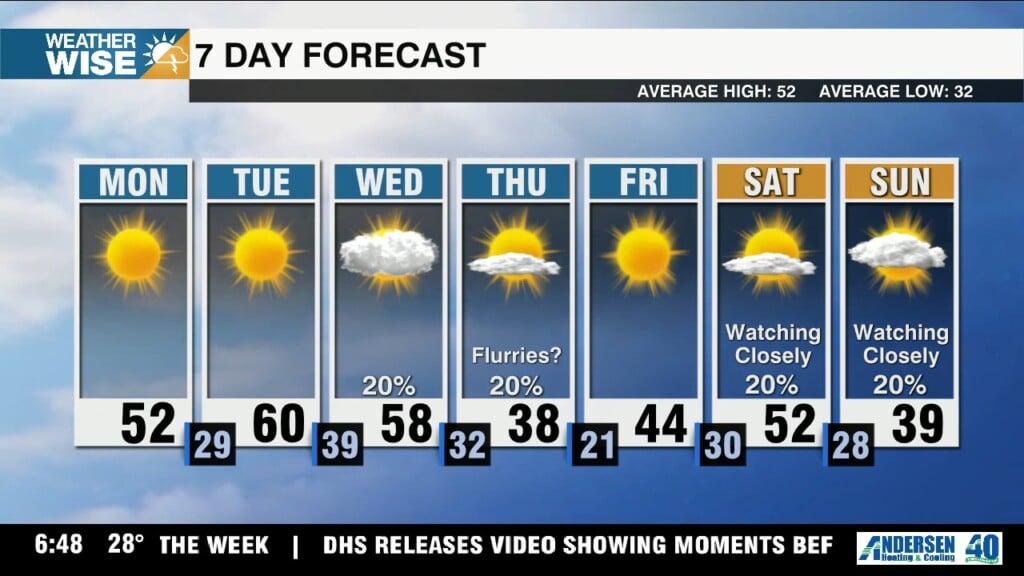
Dense fog will impact your Monday morning commute, but the week ahead looks much brighter beyond today.
A classic Carolina wedge sets up shop this Friday afternoon as two very different airmasses fight over the WCCB Charlotte viewing area this weekend.
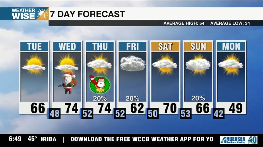
Merry Christmas Eve Eve! Get ready for one of the warmest Christmases on record.
 Formerly Twitter