Highs on the rise through holiday week
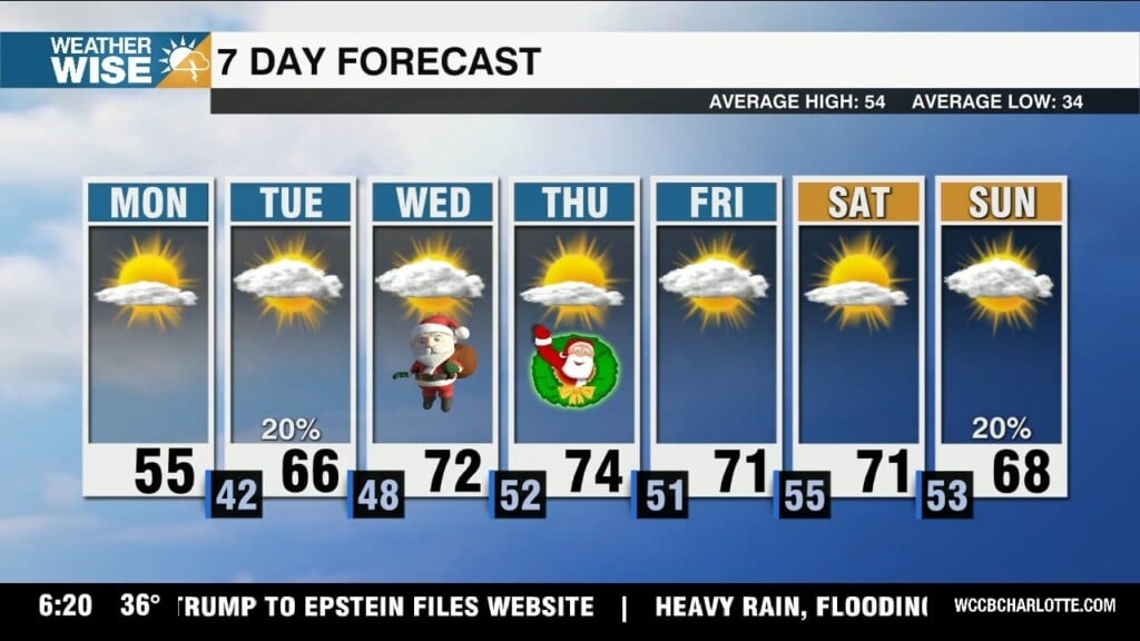
Santa may be delivering gifts in his finest Tommy Bahama this week as highs surge into near-record territory.

Santa may be delivering gifts in his finest Tommy Bahama this week as highs surge into near-record territory.
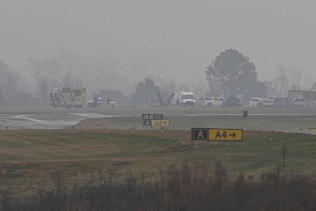
A business jet carrying seven people, including retired NASCAR race driver Greg Biffle and his family, crashed Thursday in Statesville, killing everyone aboard, authorities said.
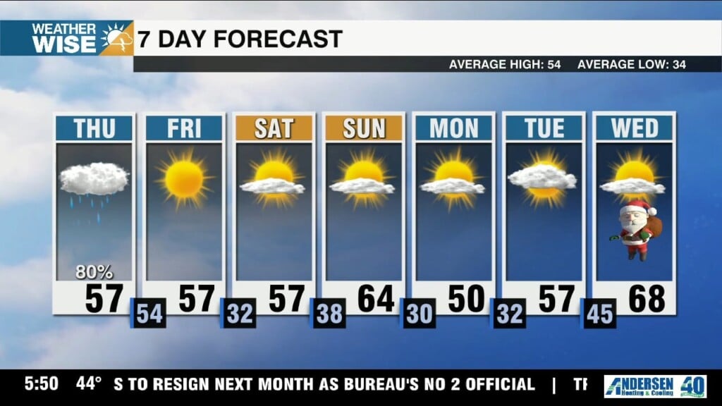
Rain chances and gusty winds pick up throughout our penultimate day of the workweek before cooler and drier air settles in on Friday.
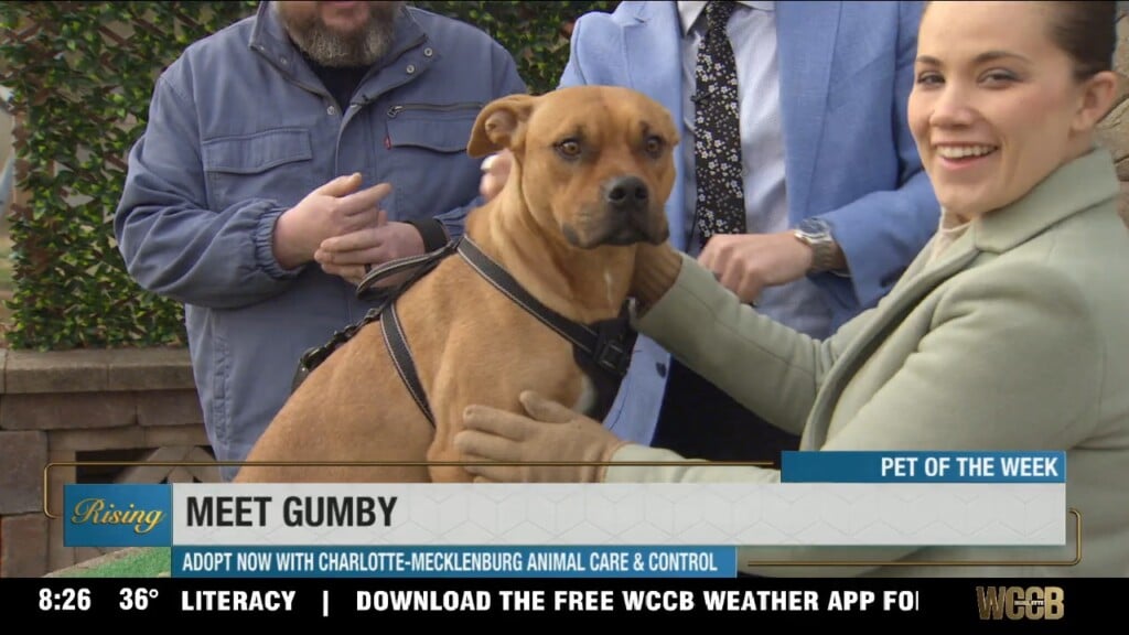
Rising’s Pet of the Week from Charlotte-Mecklenburg Animal Care & Control is Gumby! A year-and-a-half-old Black Mouth Cur mix, Gumby is a calm, sweet, and affectionate furry friend. Learn more about this sweet boy HERE.
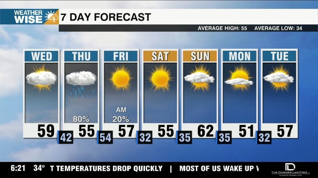
The WCCB Charlotte viewing area stays dry through Wednesday, but drought-denting rainfall returns for many on Thursday.
Highs are on the rise once again this week ahead of Thursday's rainmaking system.
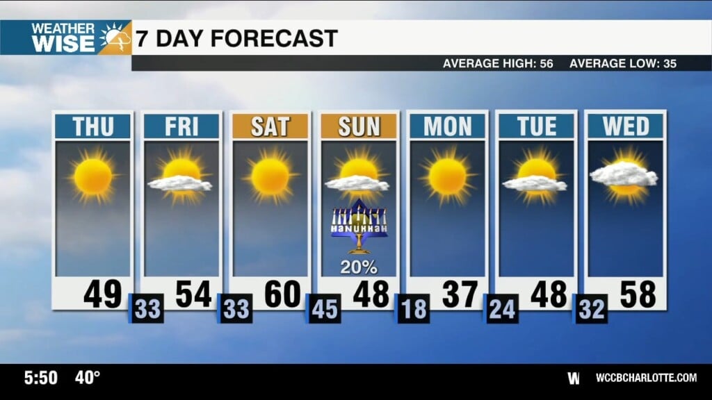
The WCCB Charlotte viewing area is waking up its coldest morning in nearly two years, but temperatures quickly return to above-normal territory by midweek.

WCCB Charlotte is proud to partner with HITS 96.1, 96.9 THE KAT, 106.5 The End, and other iHeartRadio Charlotte stations as the second-annual STUFF-A-BUS Toy Drive gets going.
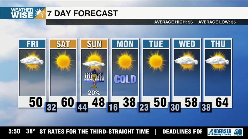
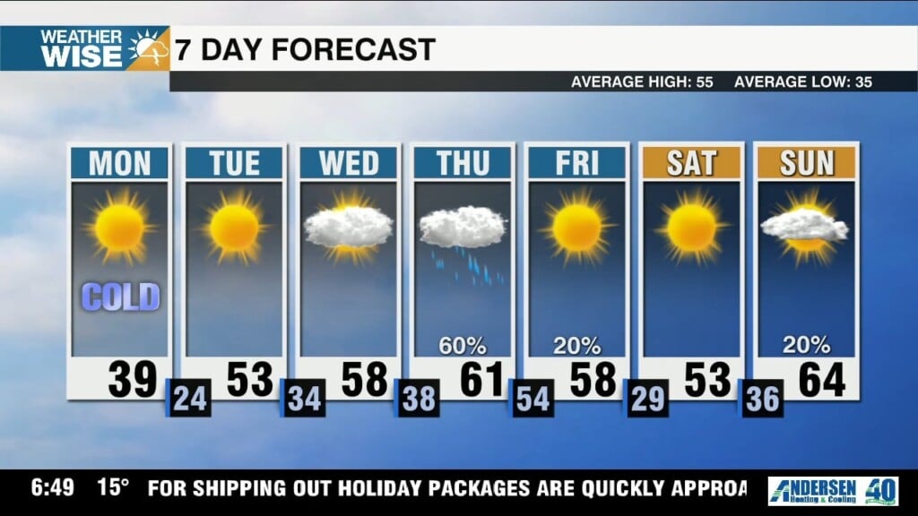
Highs surge near 60° for most on Saturday, but the coldest air we've seen in nearly two years arrives by Monday morning.
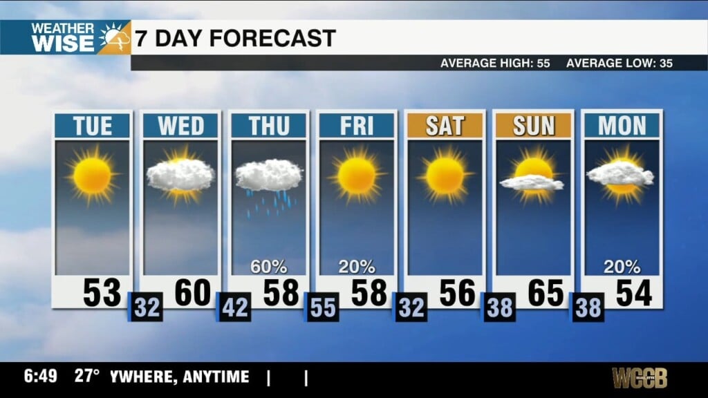
Colder air settles back into the Carolinas for our penultimate day of the workweek, but highs surge near 60° on Saturday.
 Formerly Twitter