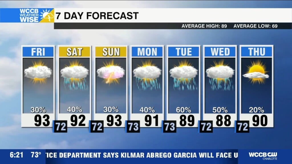
Tropical feels through early next week
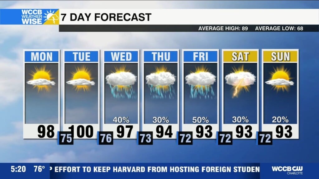
Scattered afternoon storms each day with highs in the low 90s and storm chances continuing into the holiday week.

Scattered afternoon storms each day with highs in the low 90s and storm chances continuing into the holiday week.
Another hot and humid day with heat indices up to 105 to 108 and scattered strong storms possible this afternoon and evening.
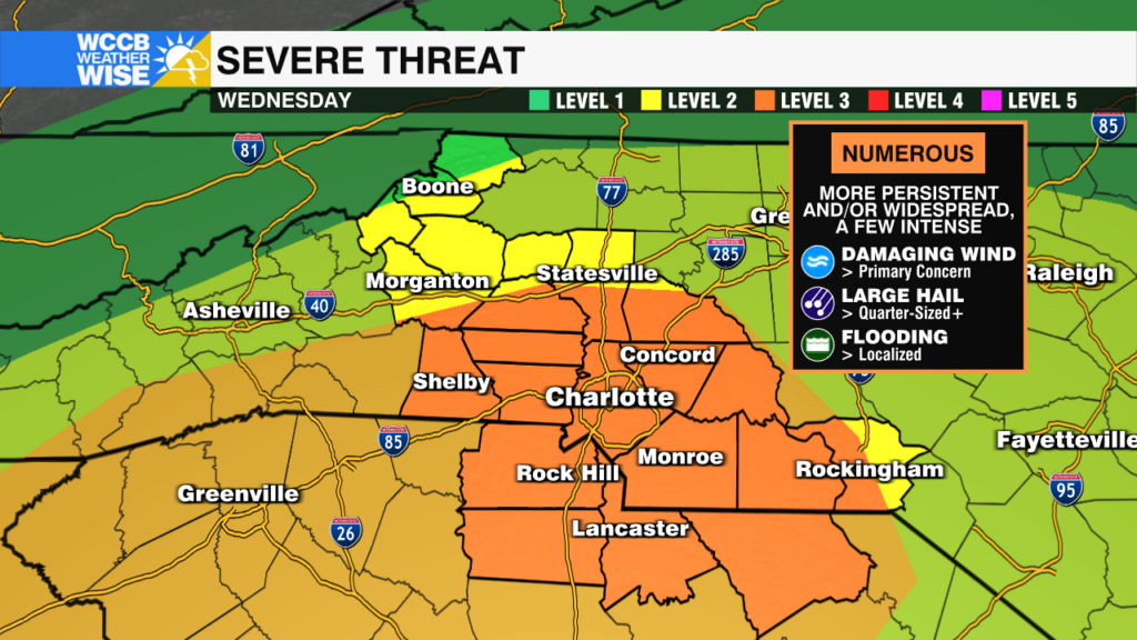
The environment is primed for explosive thunderstorms beginning Wednesday afternoon, as the threat of severe storms, damaging wind increases.

Heat Advisory remains in effect as highs soar to near 100 again this afternoon. Instability will lead to scattered strong to severe storms capable of producing damaging wind and heavy downpours.
Heat Advisory in effect through midweek with highs near 100 and heat index values 105+, ahead of scattered strong storms Wednesday.
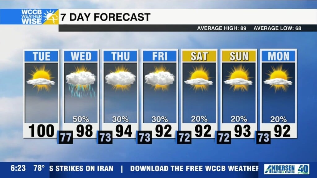
Dangerous heat builds in this week with highs reaching the upper 90s, but heat index values pushing to 103-108.
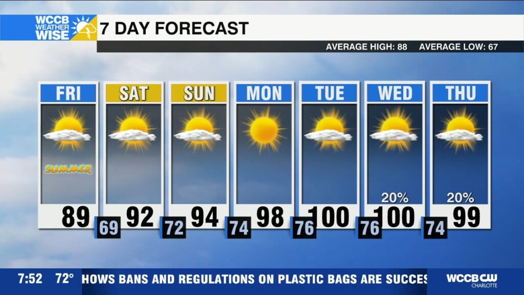
Lower humidity today with highs near 90, but heat and humidity build back in this weekend ahead of dangerous heat next week.
Humidity builds ahead of a cold front that will bring scattered storms, a few could be strong to severe this afternoon.

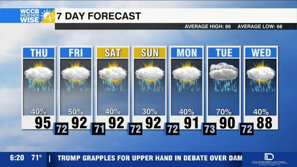
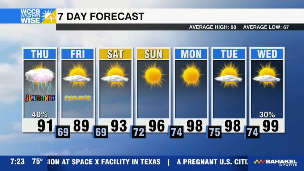
Hot and humid today with highs near 90,. A cold front brings more organized storms with the threat of damaging wind Thursday.

Scattered storms return this afternoon with highs near 90, and heat index values near the triple digits
 Formerly Twitter