Severe Weather Preparedness Week: overview and severe weather types
Severe Weather Preparedness Week is underway in the Carolinas, running from March 2-8, 2025.


Severe Weather Preparedness Week is underway in the Carolinas, running from March 2-8, 2025.
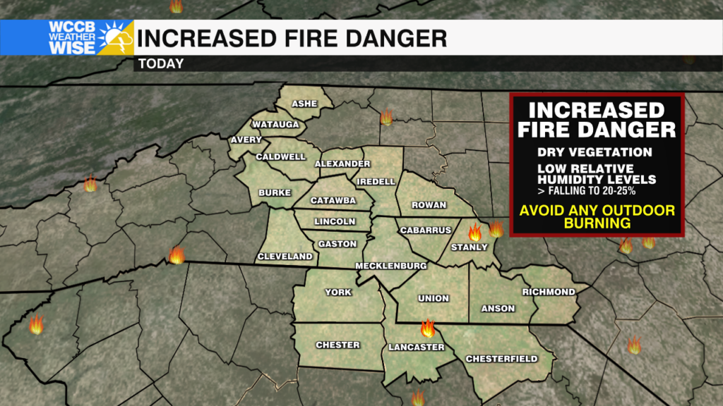
Wildfires continue to burn across Carolinas, prompting evacuations, an emergency declaration and burn bans as the fire danger remains elevated.
The fire danger remains elevated today, as dry conditions persist. Heavy rain and a few strong to severe storms possible Wednesday.
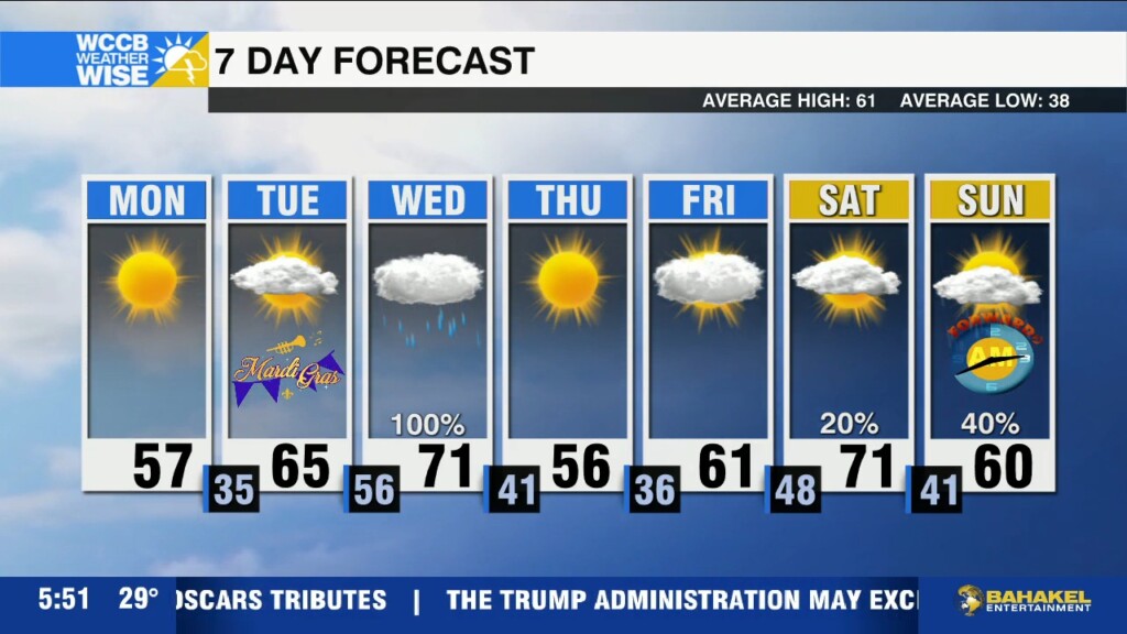
Mild and breezy today with highs reaching the 70s ahead of an afternoon cold front that will bring scattered showers and an isolated storm, or two.
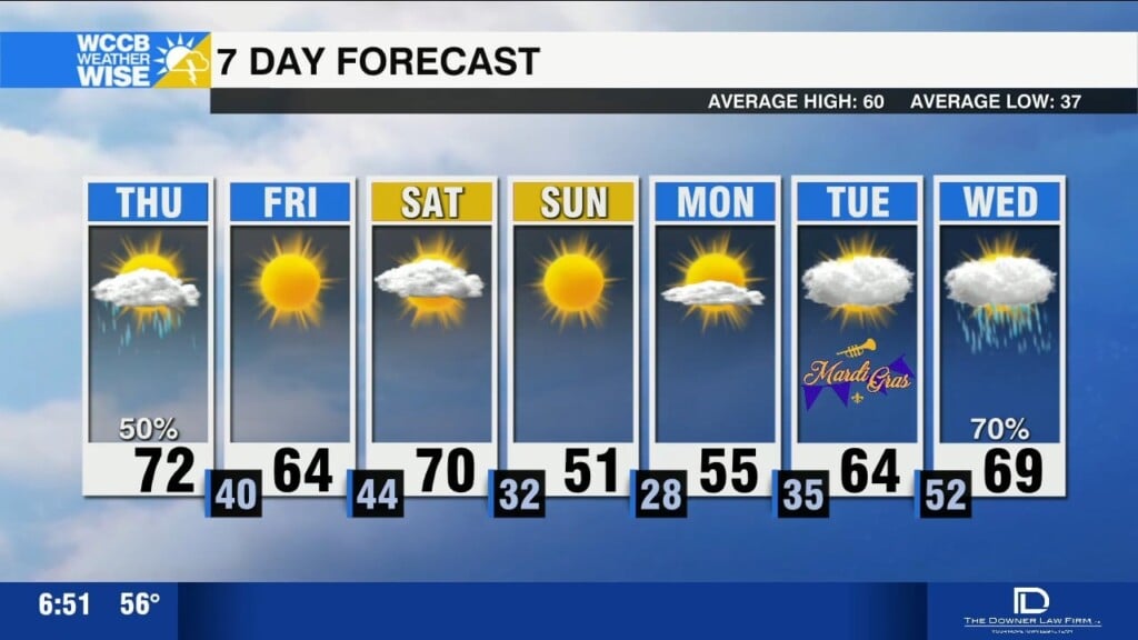
Pleasant and dry today with highs in the mid 70s, ahead of a cold front that will bring spotty showers Thursday afternoon.
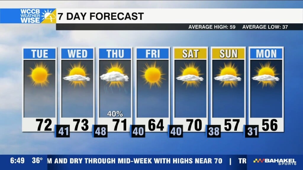
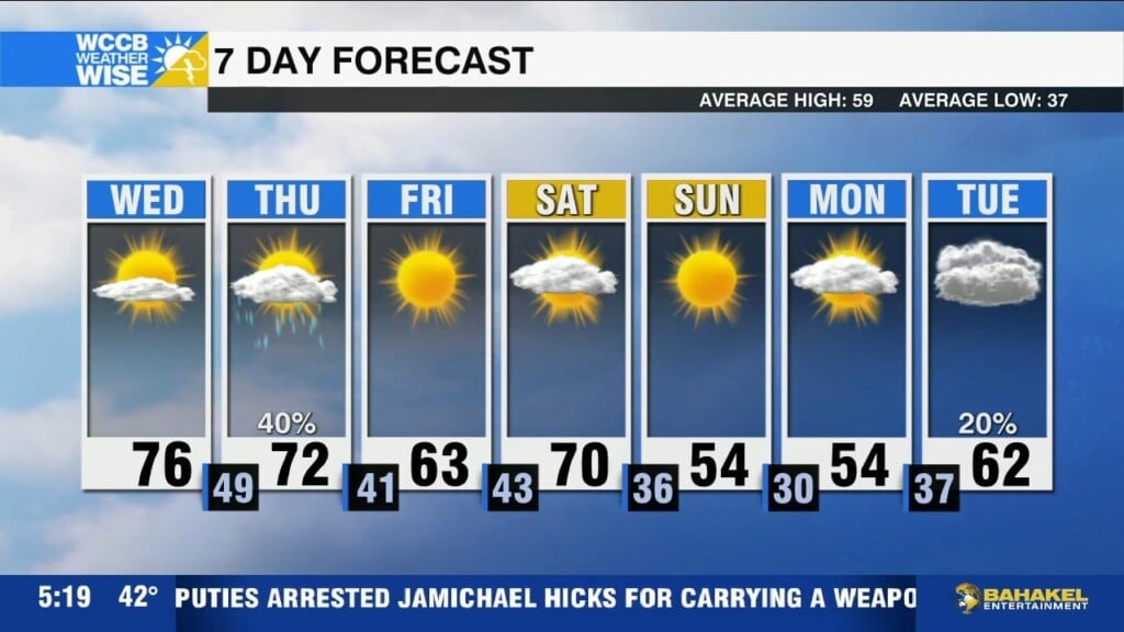
Warm and dry through mid-week with highs near 70 before a weak cold front brings scattered showers Thursday.
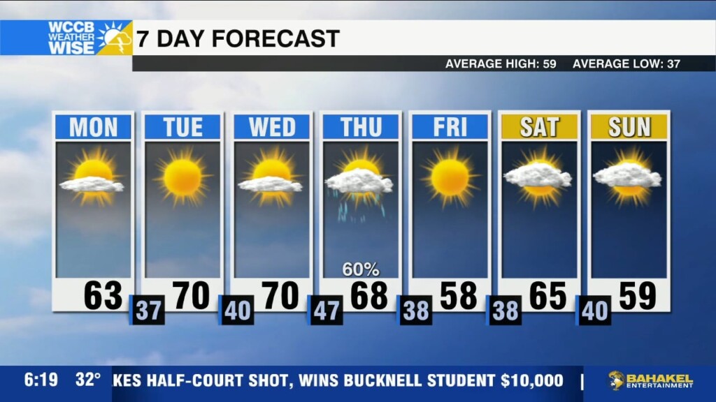
Warm and dry through mid-week with temperatures reaching the low to mid 60s Monday, and reaching the 70s by Tuesday afternoon.
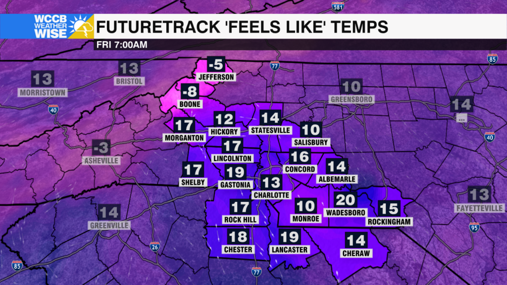
Bitter cold today with wind chills ranging from below zero in the mountains to the low teens across the Piedmont this morning. Gradual warm up this weekend with highs back near 60 by Monday.

Local school districts are making changes Friday, February 21 due to winter weather.
Gusty northwest winds will usher in bitter cold air Thursday night, sending temperatures tumbling and creating dangerous wind chills.
 Formerly Twitter