Winter Storm Watch in effect Friday
Winter Storm Watch in effect with a mix of snow, sleet and freezing rain expected to begin Friday midday through Saturday morning.

Winter Storm Watch in effect with a mix of snow, sleet and freezing rain expected to begin Friday midday through Saturday morning.
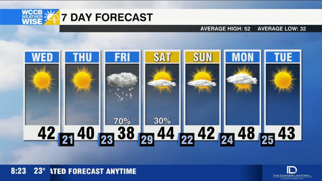
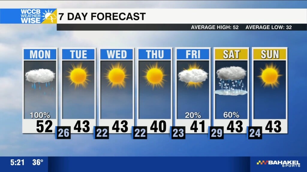
Cold through the end of the week with highs in the 30s and 40s. Winter storm bringing snow and ice to the region Friday into Saturday.
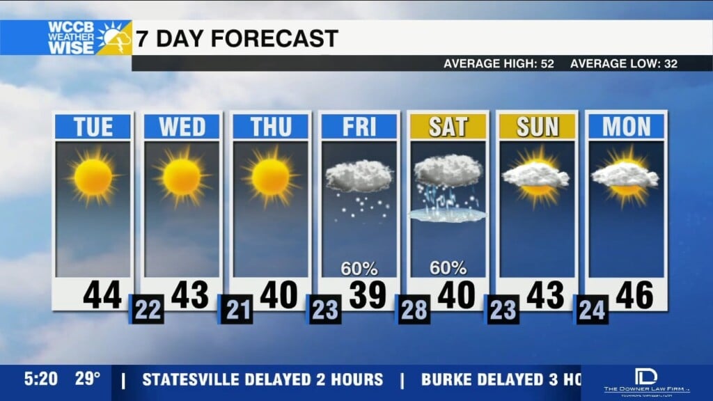
Bitter cold grips the region through the end of the week with highs in the 30s and 40s and lows falling into the teens and 20s.

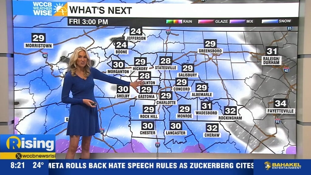
Winter storm warnings and winter weather advisories in effect for parts of the region as snow, freezing rain and gusty winds cause travel issues across the mountains and foothills.
Rain and freezing rain will make the morning commute slick, especially for areas near and north of I-40. Gusty winds this afternoon with an arctic air mass settling in tonight.

A strong cold front will bring snow, gusty winds and frigid temperatures to the High Country. Here's the latest on the potential impacts:
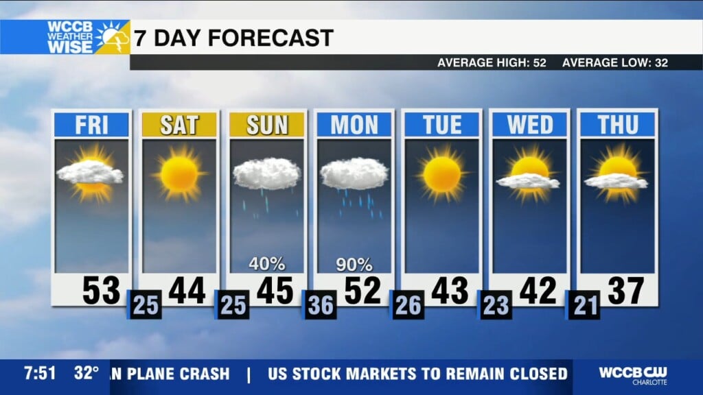
A strong cold front will bring mountain snow along with gusty winds and colder temperatures for the weekend.
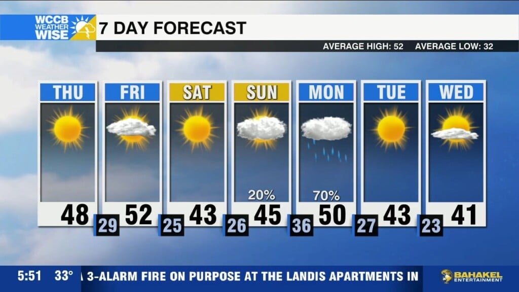
Colder today with highs topping out in the mid to upper 40s under sunny skies. An arctic front brings mountain snow and gusty winds Friday with a frigid weekend ahead.
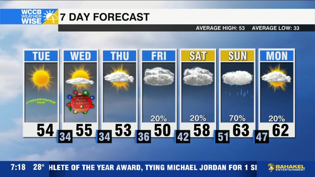
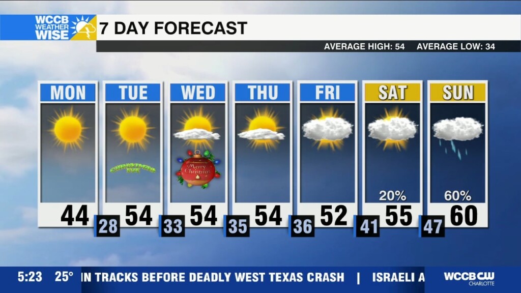
Sunny and seasonable for the holidays with highs back in the mid 50s through Thursday. Warming up into the 60s with the return of rain chances this weekend.
The bitter cold lingers today with highs only reaching the mid 40s. Chance of light freezing rain early Tuesday south and east of I-85 before seasonable temperatures return for the holidays.
 Formerly Twitter