Mountain snow with a frigid weekend areawide
A fast moving clipper system will bring snow to the NC mountains beginning this afternoon. followed by bitterly cold air and gusty winds across the region this weekend.

A fast moving clipper system will bring snow to the NC mountains beginning this afternoon. followed by bitterly cold air and gusty winds across the region this weekend.
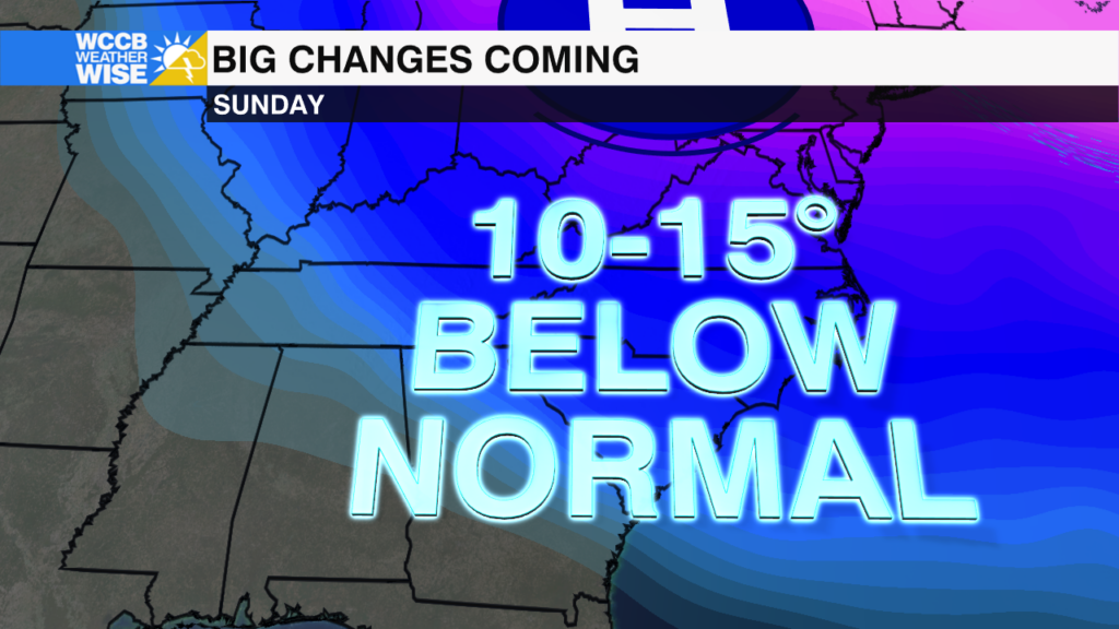
Snow in the mountains and an Arctic chill could disrupt holiday travel plans and last minute errands - here's what you need to know.
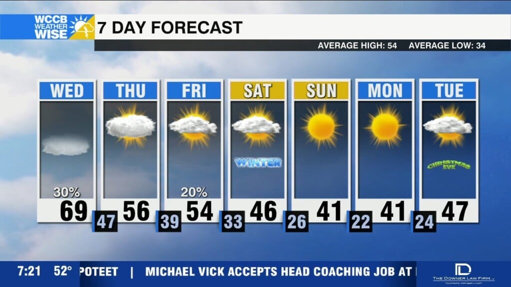
Noticeably cooler today with highs reaching the mid 50s this afternoon. Much colder temperatures ahead for the weekend.
Dense fog this morning will give way to a warm and breezy day with highs in the upper 60s to lower 70s. A cold front arrives tonight with rain and isolated storms.
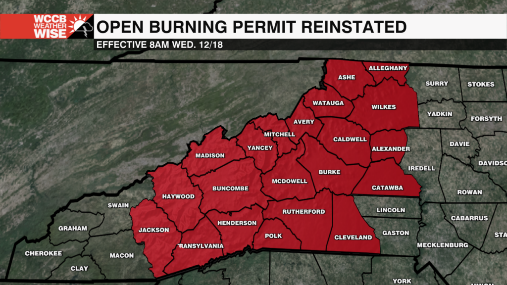
The N.C. Forest Service has reinstated open burning permits after progress in recovery efforts to ensure safe burning practices.
A dense fog advisory is in effect until 9am, with low visibility creating tricky travel this morning. Warmer temps continue today and tomorrow with highs reaching the upper 60s to near 70.
Morning fog and drizzle, as a pesky wedge keeps the forecast cool and cloudy with highs in the 50s this afternoon.
Sunny and cool today with highs ranging from the 30s in the mountains to the low 50s across the Piedmont, with frost tonight as temperatures fall below freezing.
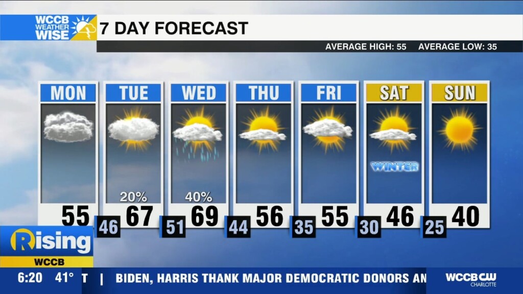
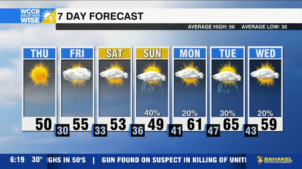
Behind Wednesday's cold front winds could gust up to 55 mph, freezing temperatures and a burst of snow for the mountains.
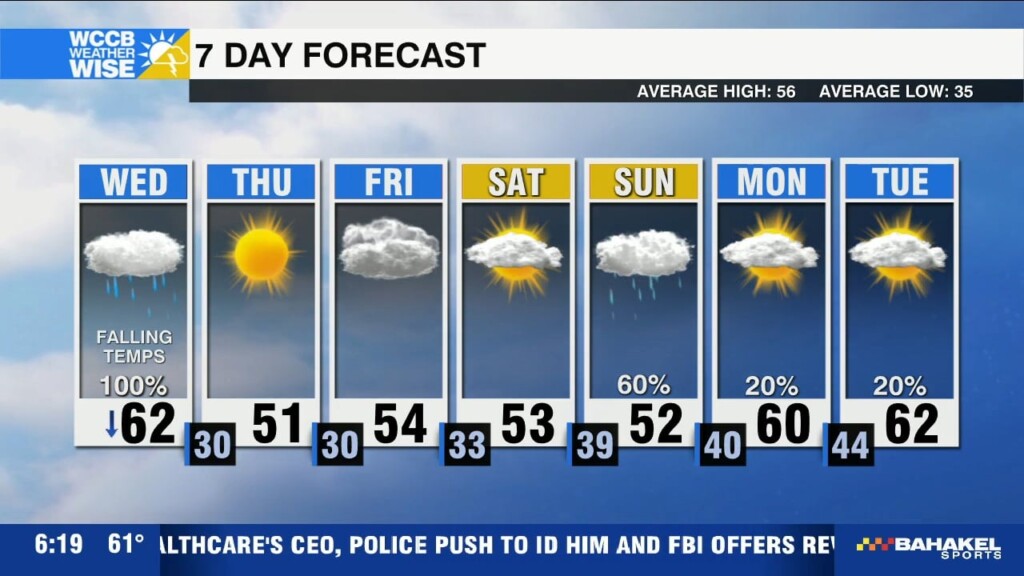
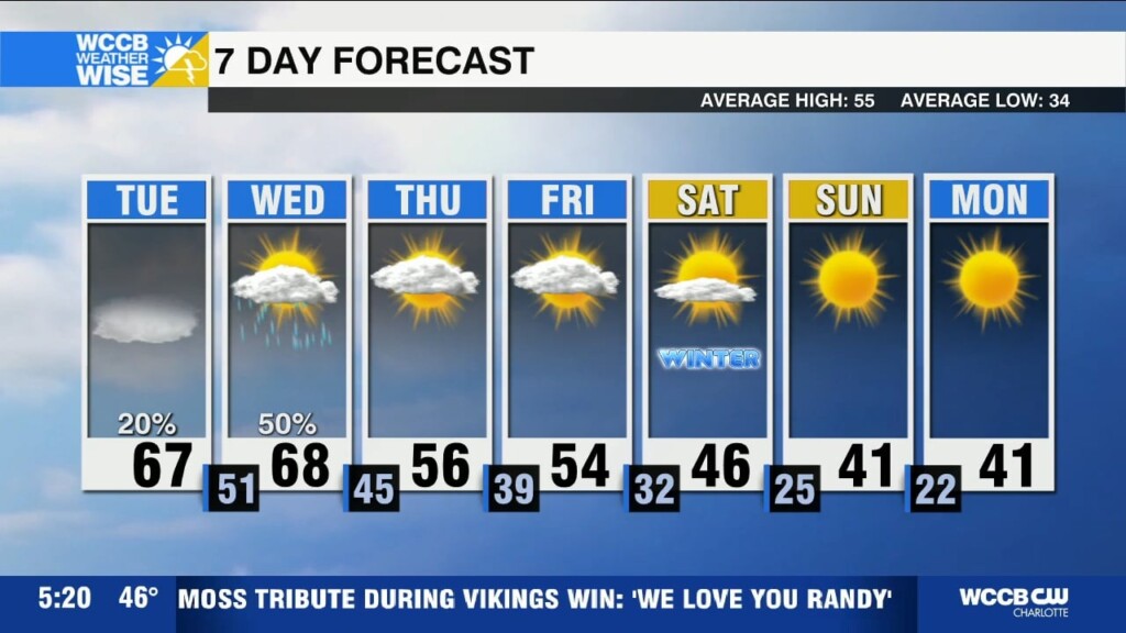
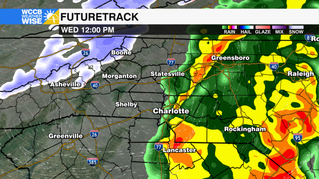
A strong cold front is bringing heavy rain and causing a messy commute this morning with localized flooding possible. Temperatures will tumble from near 60 this morning to the mid 40s this afternoon with gusty winds post cold front.
 Formerly Twitter