Morganton Christmas Parade rescheduled due to inclement weather
Rain, gusty wind and the risk of flooding have postponed tonight's parade -- here's when it's rescheduled and what else you can expect WeatherWise.

Rain, gusty wind and the risk of flooding have postponed tonight's parade -- here's when it's rescheduled and what else you can expect WeatherWise.
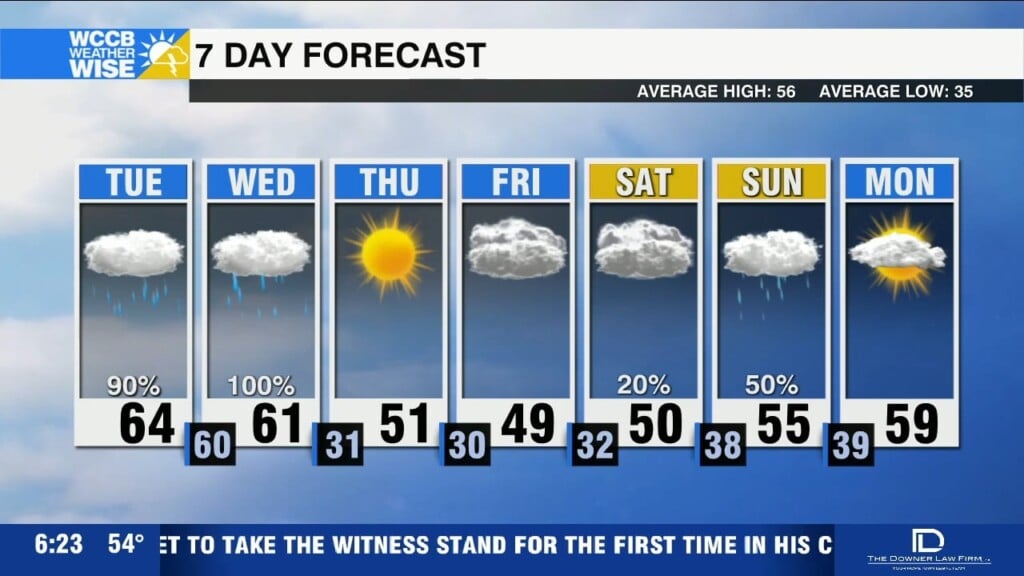
A dense fog advisory is in effect until 10am. Heavy rain tonight through Wednesday morning, bringing 1-3 inches of rainfall and localized flooding concerns.
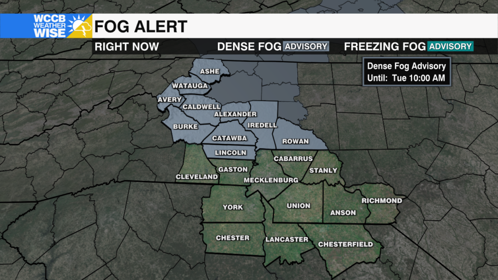
Visibility is down to less than 1/4 of a mile or less across much of the region this morning.
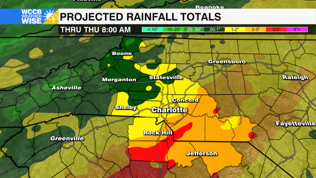
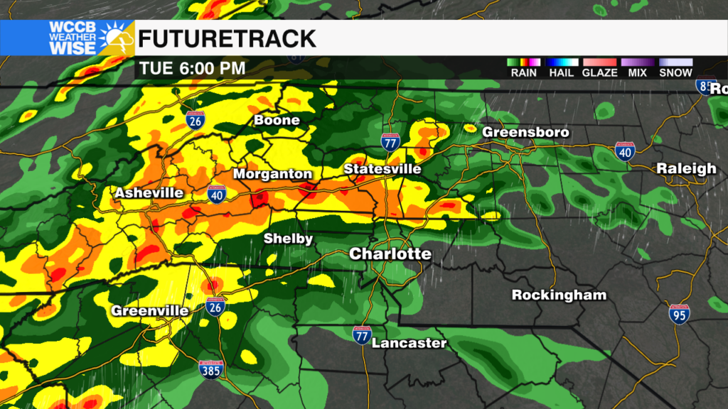
Heavy rain, localized flooding and isolated severe storms will be possible ahead of a strong cold front Tuesday night into Wednesday morning for the Carolinas.
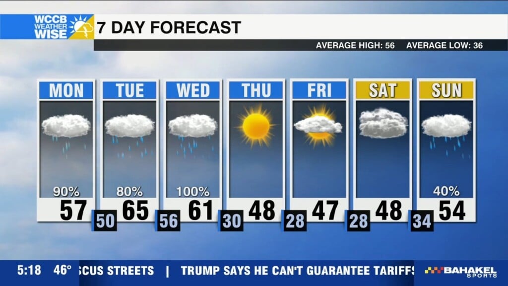
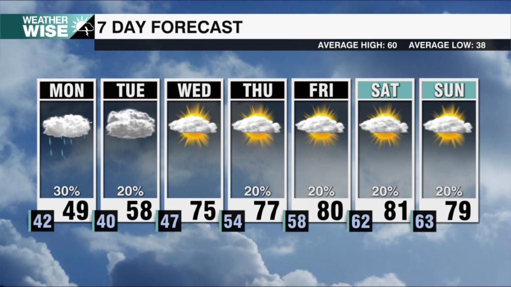
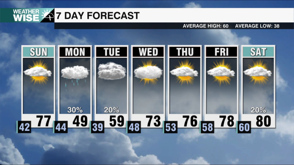
Rain tapers off late this morning with highs reaching the upper 50s. Heavier rain and isolated storms Tuesday night into Wednesday before colder air arrives to close out the week.
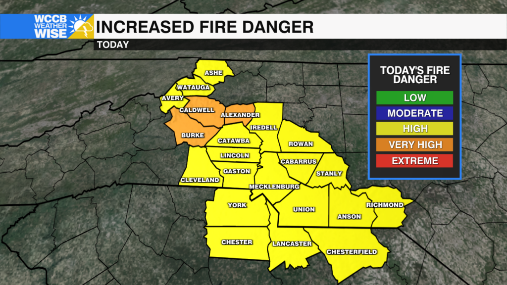
Dry air and gusty winds will create dangerous fire conditions Thursday afternoon.
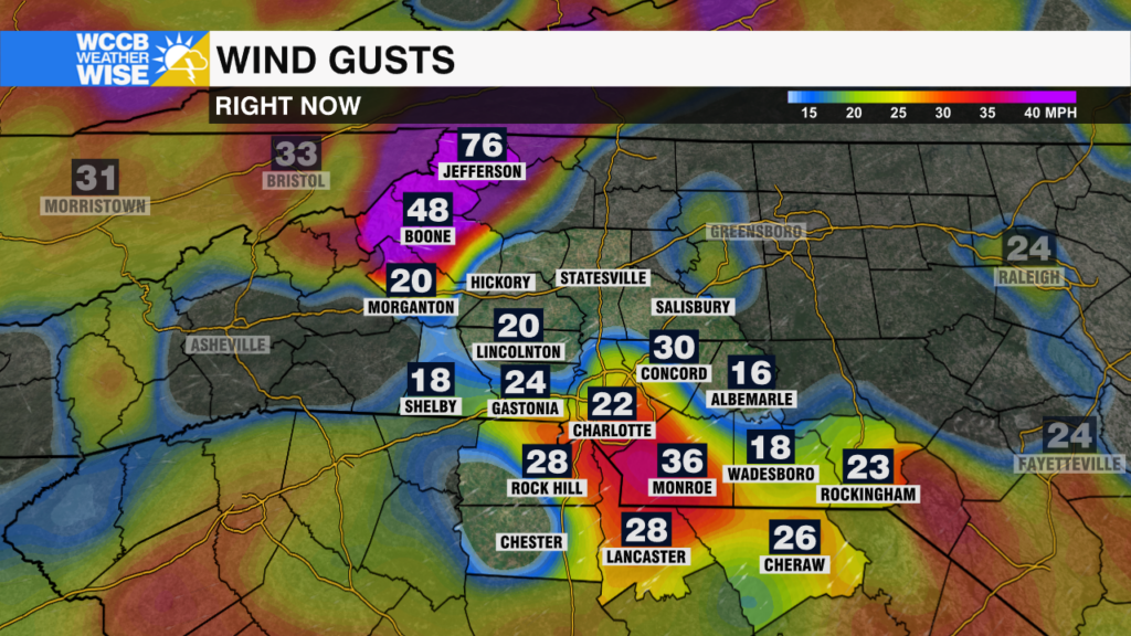
High winds are causing disruptions across the High Country today, closing schools and delaying county operations.
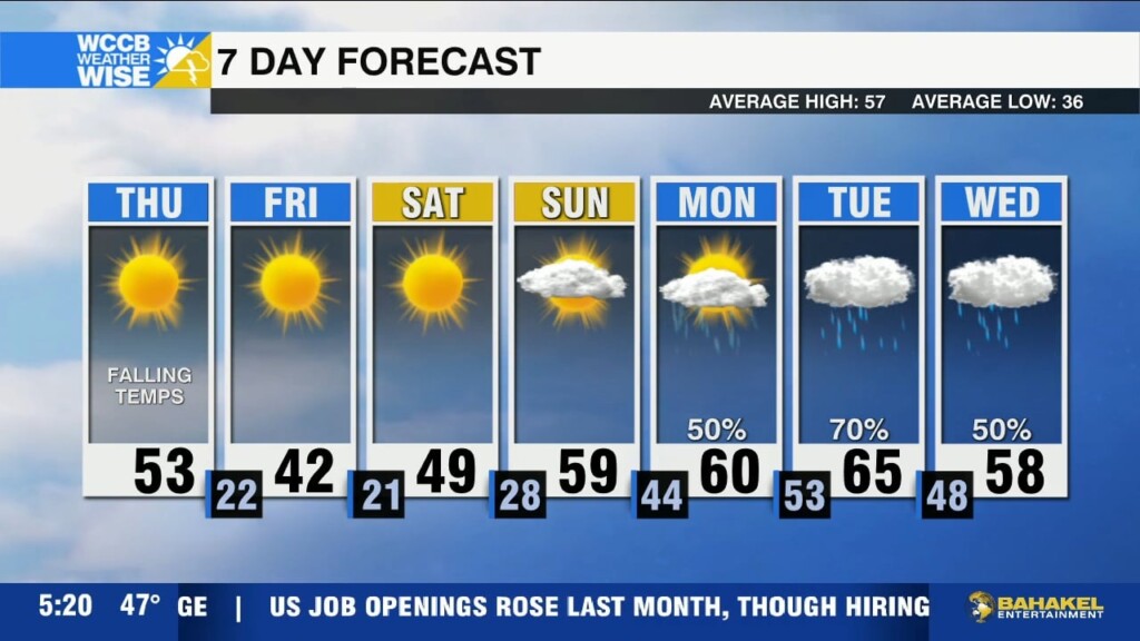
A strong cold front today brings gusty wind and falling temperatures today, leading to frigid lows in the teens and low 20s by Friday morning. Warmer and wetter weather returns next week.
After a freezing start, temperatures will top out near 50 this afternoon, but a strong cold front will bring gusty winds and more frigid temperatures to end the week.
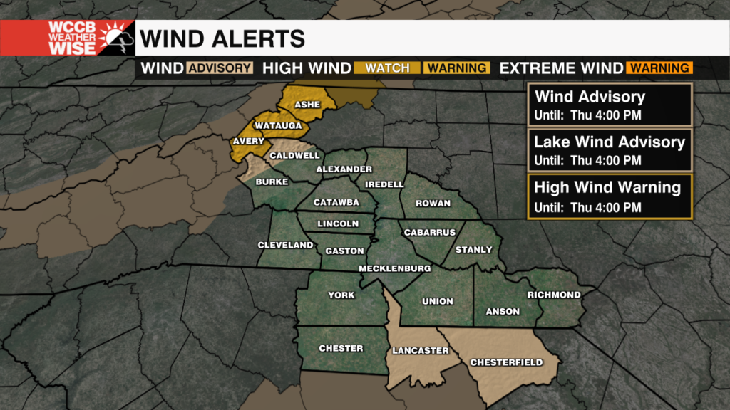
A High Wind Warning will go into effect Wednesday night for the mountains, with gusts up to 60 mph possible.
 Formerly Twitter