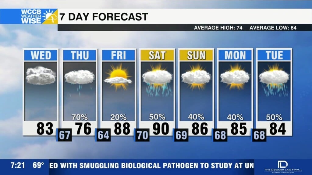
Steamy week, flooding concerns
Flood Watches in effect today; slow-moving storms may trigger flash flooding north and east of Charlotte.

Flood Watches in effect today; slow-moving storms may trigger flash flooding north and east of Charlotte.
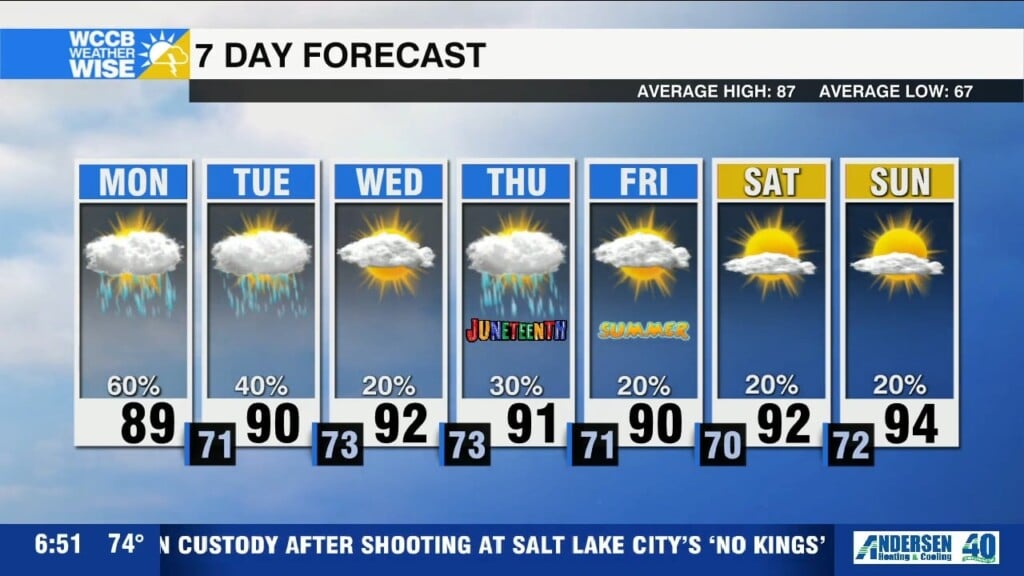
Hot and humid with scattered storms each afternoon—highs upper 80s to low 90s; locally heavy rain and gusty winds possible.
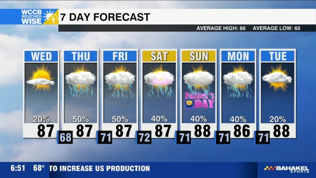
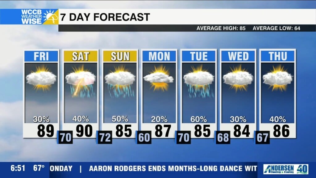
Lower humidity and plenty of sunshine to take advantage of Wednesday, ahead of a steamy weekend.
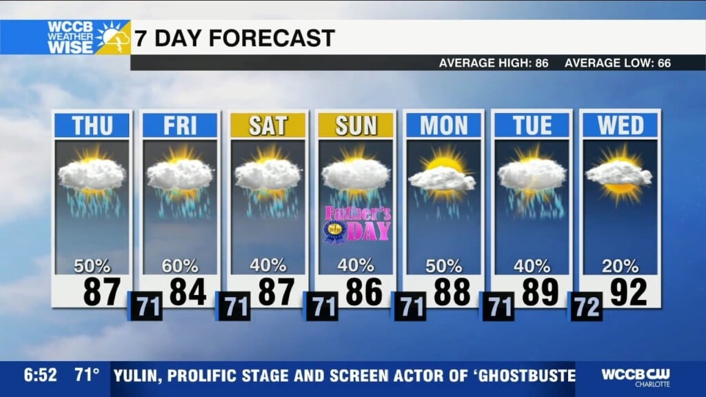
A cold front will bring scattered storms today with highs in the mid 80s, with noticeably lower humidity and sunshine returning Wednesday.
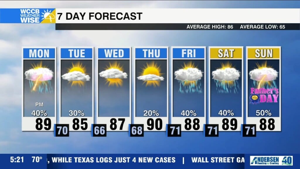
Hot and humid with highs near 90 this afternoon, ahead of a few strong evening storms with gusty winds.
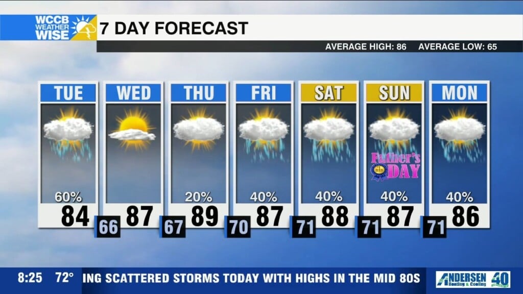
Heat and humidity will soar this weekend with highs near 90 with an active pattern of daily storm chances including strong to severe storms possible.
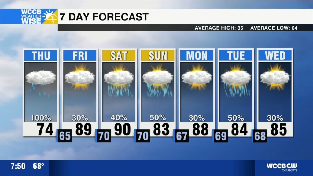
Low pressure system pulling tropical moisture into the region today with waves of showers and a few storms as highs struggle to break out of the mid 70s.
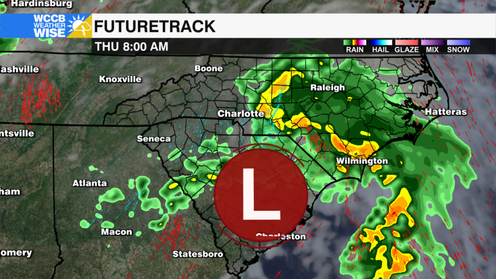
The National Hurricane Center is forecasting a 0% chance of tropical development for the disturbance lifting out of Florida, but the threat of heavy rain and potential flash flooding remains for the Carolinas.
Coastal low brings rain tonight into Thursday with weekend storms possible
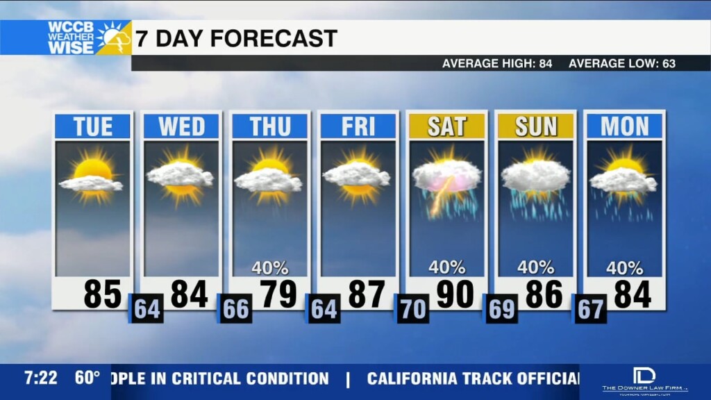
Humidity remains low today as highs rise into the low to mid 80s.
 Formerly Twitter