High Pressure Brings Quiet, But Warm End To Work Week
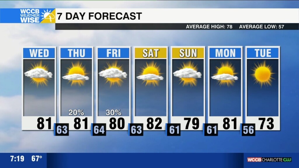
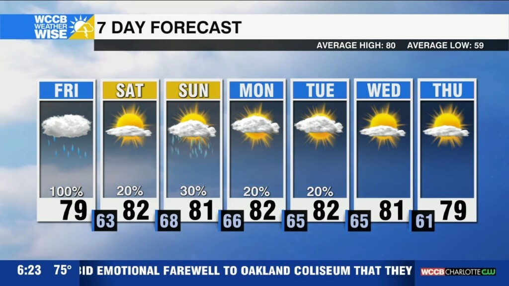
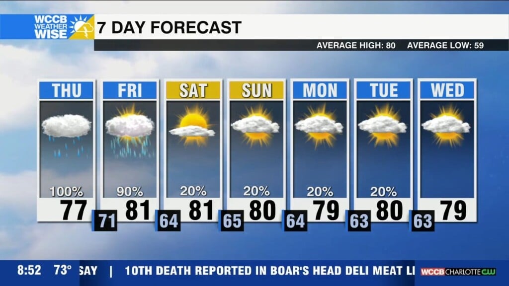
A weak cold front will bring an isolated shower today with highs reaching the low 80s. Dry and mild through Friday with cooler, more crisp conditions early next week.

A weak cold front will bring an isolated shower today with highs reaching the low 80s. Dry and mild through Friday with cooler, more crisp conditions early next week.

The United Cajun Navy is on the ground helping local communities hit hardest by Hurricane Helene. Here's how you can support their relief efforts:
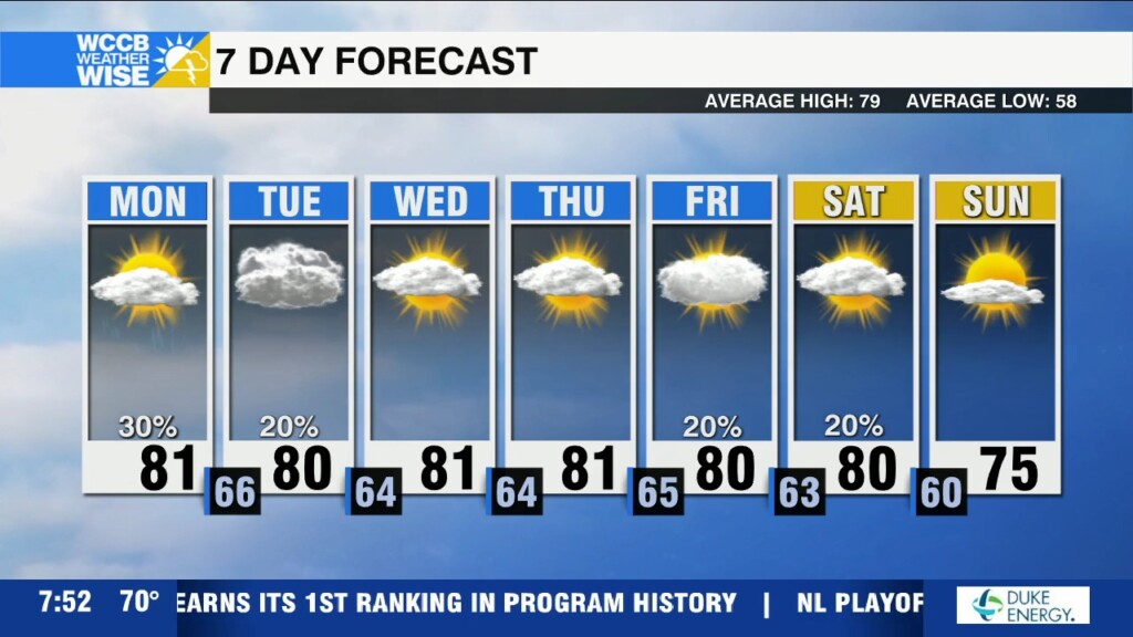
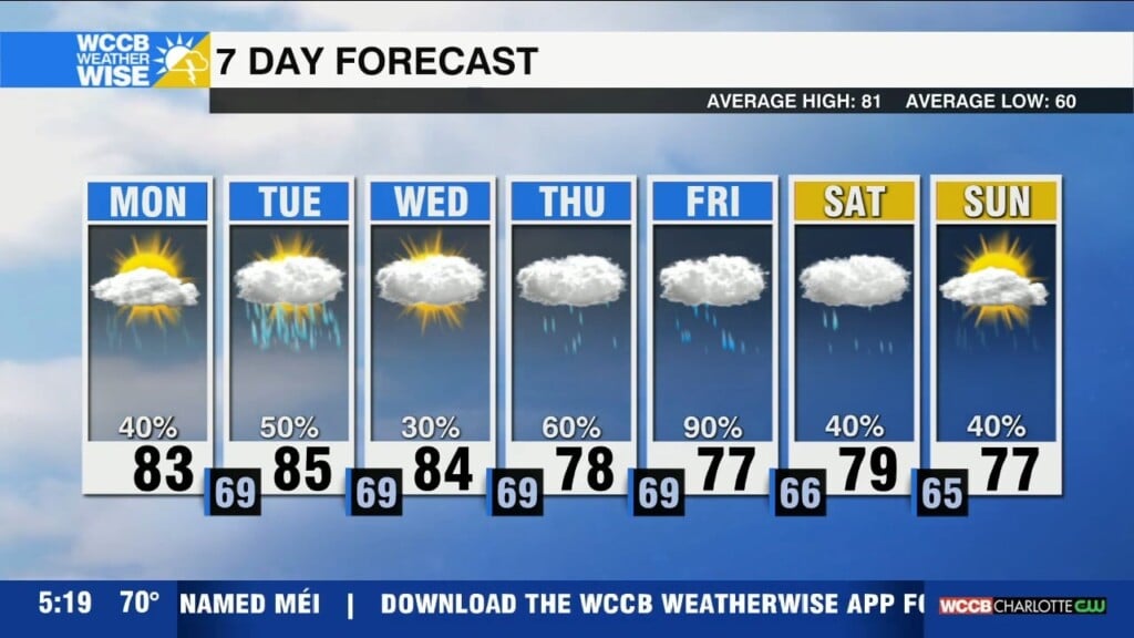
Expect patchy dense fog and more scattered afternoon showers Tuesday. A cold front arrives mid-week supplying drier air and more sunshine to end the week.
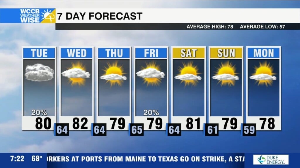
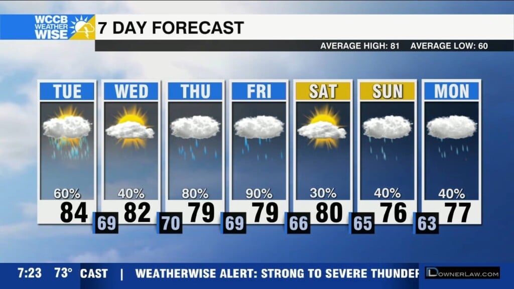
Scattered showers today with clearing by midweek and cooler and drier air arriving by the weekend.
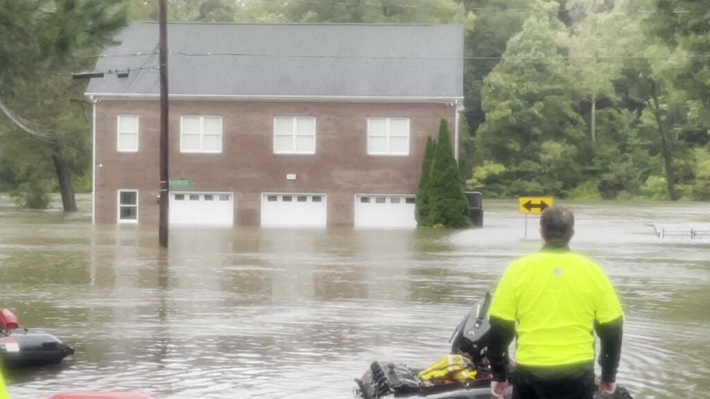
The last of the rain from Helene has cleared out, but impacts will linger for days, if not weeks.
Hurricane Helene will bring heavy rain, catastrophic flash flooding and damaging wind to the region through Friday morning, with significant flood risks leading to landslides in the mountains and widespread power outages expected. Conditions improve by Friday afternoon with a calmer weekend ahead.
Flash flooding, gusty winds and a few tornadoes will all be possible through Friday morning across the Carolinas.
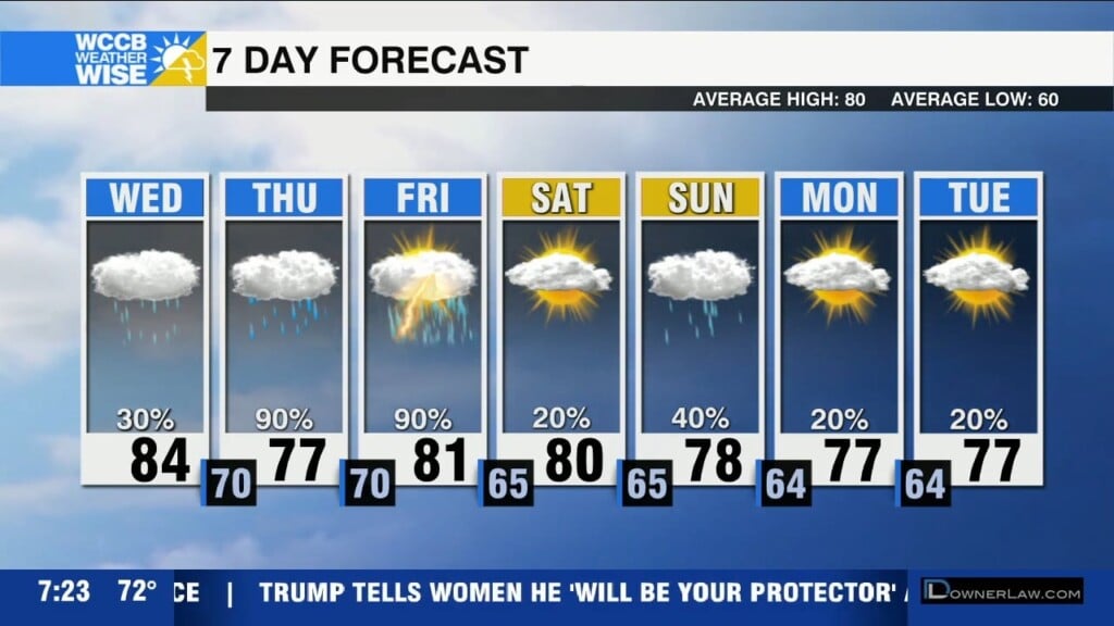
A flood watch is in effect for the mountains and foothills with heavy rain and storms possible ahead of Helene. Significant impacts from Helene begin Thursday night, peaking Friday morning and include heavy rain, flash flooding, gusty wind and isolated tornadoes.
Strong to severe storms possible this afternoon with the biggest threats being damaging wind and hail. A tropical system will bring heavy rain, flooding and strong winds to the region by Thursday night.
Cloudy start to the day with afternoon peeks of sunshine and highs reaching the low to mid 80s. A disturbance will spark showers and storms this afternoon and evening -- a few strong to even severe possible with damaging wind the greatest concern.
 Formerly Twitter